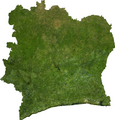
चित्र:Côte d'Ivoire sat.png

इस पूर्वावलोकन का आकार: 573 × 600 पिक्सेल। दूसरे रेसोल्यूशन्स: 229 × 240 पिक्सेल | 459 × 480 पिक्सेल | 733 × 767 पिक्सेल।
मूल चित्र ((733 × 767 पिक्सेल, फ़ाइल का आकार: 805 KB, MIME प्रकार: image/png))
चित्र का इतिहास
फ़ाइलका पुराना अवतरण देखने के लिये दिनांक/समय पर क्लिक करें।
| दिनांक/समय | थंबनेल | आकार | सदस्य | प्रतिक्रिया | |
|---|---|---|---|---|---|
| वर्तमान | 04:12, 13 जुलाई 2006 |  | 733 × 767 (805 KB) | Unquietwiki | ECW to TIFF to PNG (compression level 9). {{PD-MapLibrary}} |
चित्र का उपयोग
निम्नलिखित पन्ने इस चित्र से जुडते हैं :
चित्र का वैश्विक उपयोग
इस चित्र का उपयोग इन दूसरे विकियों में किया जाता है:
- af.wikipedia.org पर उपयोग
- be.wikipedia.org पर उपयोग
- en.wikipedia.org पर उपयोग
- es.wikipedia.org पर उपयोग
- fr.wikipedia.org पर उपयोग
- gl.wikipedia.org पर उपयोग
- id.wikipedia.org पर उपयोग
- ka.wikipedia.org पर उपयोग
- ms.wikipedia.org पर उपयोग
- pl.wikipedia.org पर उपयोग
- uk.wikipedia.org पर उपयोग
