चित्र:Satellite image of Croatia in September 2003.jpg

इस पूर्वावलोकन का आकार: 620 × 599 पिक्सेल। दूसरे रेसोल्यूशन्स: 248 × 240 पिक्सेल | 496 × 480 पिक्सेल | 794 × 768 पिक्सेल | 1,059 × 1,024 पिक्सेल | 2,172 × 2,100 पिक्सेल।
मूल चित्र ((2,172 × 2,100 पिक्सेल, फ़ाइल का आकार: 1.59 MB, MIME प्रकार: image/jpeg))
|
|
यह फ़ाइल विकिमेडिया कॉमन्स से है। वहाँ पर इसका विवरण पृष्ठ निम्नोक्त है। कॉमन्स मुक्त लाइसेंसों के अंतर्गत उपलब्ध मीडिया फ़ाइलों का संग्रह है। आप भी इसमें मदद कर सकते हैं। |
| Description |
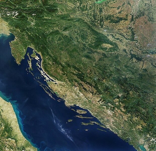
English: Satellite image of Croatia |
|||||||||
| दिनांक | ||||||||||
| स्रोत | Satellite image of Croatia in September 2003. Cropped image, original taken from NASA's Visible Earth http://visibleearth.nasa.gov/view_rec.php?id=5947 archive copy at the Wayback Machine | |||||||||
| रचियता |
NASA |
|||||||||
| अनुमति (इस चित्र का पुनः उपयोग करना) |
|
|||||||||
| Geotemporal data | ||||||||||
| Bounding box |
|
|||||||||
| Georeferencing | ||||||||||
| दूसरे संस्करण |
|
|||||||||


चित्र का इतिहास
फ़ाइलका पुराना अवतरण देखने के लिये दिनांक/समय पर क्लिक करें।
| दिनांक/समय | थंबनेल | आकार | सदस्य | प्रतिक्रिया | |
|---|---|---|---|---|---|
| वर्तमान | 12:27, 3 अक्टूबर 2023 | | 2,172 × 2,100 (1.59 MB) | Ponor | new crop for use in location maps like File:Croatia_relief_map.png |
| 20:43, 7 मई 2005 |  | 1,912 × 1,894 (688 KB) | Boabo~commonswiki | ||
| 12:41, 3 जनवरी 2005 |  | 1,912 × 1,894 (587 KB) | Hautala | {{PD-USGov-NASA}} Satellite image of Croatia in September 2003. Cropped image, original taken from NASA's Visible Earth http://visibleearth.nasa.gov/cgi-bin/viewrecord?26019 |
चित्र का उपयोग
निम्नलिखित पन्ने इस चित्र से जुडते हैं :
चित्र का वैश्विक उपयोग
इस चित्र का उपयोग इन दूसरे विकियों में किया जाता है:
- ab.wikipedia.org पर उपयोग
- ast.wikipedia.org पर उपयोग
- as.wikipedia.org पर उपयोग
- be-tarask.wikipedia.org पर उपयोग
- be.wikipedia.org पर उपयोग
- bn.wikipedia.org पर उपयोग
- bs.wikipedia.org पर उपयोग
- ca.wikipedia.org पर उपयोग
- cs.wikinews.org पर उपयोग
- de.wikipedia.org पर उपयोग
- el.wikipedia.org पर उपयोग
- en.wikipedia.org पर उपयोग
- et.wikipedia.org पर उपयोग
- eu.wikipedia.org पर उपयोग
- fi.wikipedia.org पर उपयोग
- fr.wikipedia.org पर उपयोग
- gd.wikipedia.org पर उपयोग
- hr.wikipedia.org पर उपयोग
- Hrvatska
- Hrvatska Republika Herceg-Bosna
- Zemljopis Hrvatske
- Wikipedija:Izabrani članci/2007.
- Wikipedija:Izabrani članci/18, 2007.
- Portal:Zemljopis/Izabrani članak/u izradi
- Predložak:Wikiekipa Hrvatska
- Wikipedija:Karta wikipedista (Hrvatska i susjedstvo)
- Popis osnovnih hrvatskih tema
- Modul:Location map/data/Hrvatska
- Modul:Location map/data/Hrvatska/doc
- hu.wikipedia.org पर उपयोग
- ilo.wikipedia.org पर उपयोग
- is.wikipedia.org पर उपयोग
इस चित्र के वैश्विक उपयोग की अधिक जानकारी देखें।