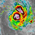
चित्र:Winston 2016-02-12 1200Z.png
Winston_2016-02-12_1200Z.png ((600 × 600 पिक्सेल, फ़ाइल का आकार: 276 KB, MIME प्रकार: image/png))
चित्र का इतिहास
फ़ाइलका पुराना अवतरण देखने के लिये दिनांक/समय पर क्लिक करें।
| दिनांक/समय | थंबनेल | आकार | सदस्य | प्रतिक्रिया | |
|---|---|---|---|---|---|
| वर्तमान | 17:22, 3 मार्च 2016 |  | 600 × 600 (276 KB) | Meow | User created page with UploadWizard |
चित्र का उपयोग
निम्नलिखित पन्ने इस चित्र से जुडते हैं :
चित्र का वैश्विक उपयोग
इस चित्र का उपयोग इन दूसरे विकियों में किया जाता है:
- ast.wikipedia.org पर उपयोग
- en.wikipedia.org पर उपयोग
- es.wikipedia.org पर उपयोग
- nn.wikipedia.org पर उपयोग
- no.wikipedia.org पर उपयोग
- or.wikipedia.org पर उपयोग
- pt.wikipedia.org पर उपयोग
- ru.wikipedia.org पर उपयोग
- uk.wikipedia.org पर उपयोग
- zh.wikipedia.org पर उपयोग


