चित्र:Atchafalaya River.png
इससे बड़ा रेसोल्यूशन उपलब्ध नहीं हैं।
Atchafalaya_River.png ((254 × 250 पिक्सेल, फ़ाइल का आकार: 7 KB, MIME प्रकार: image/png))
|
|
यह फ़ाइल विकिमेडिया कॉमन्स से है। वहाँ पर इसका विवरण पृष्ठ निम्नोक्त है। कॉमन्स मुक्त लाइसेंसों के अंतर्गत उपलब्ध मीडिया फ़ाइलों का संग्रह है। आप भी इसमें मदद कर सकते हैं। |
सारांश
| विवरण |
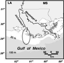
English: Atchafalaya River, Louisiana |
||||||
| स्रोत |
Modified from USGS location map at [1]
|
||||||
| लेखक | |||||||

लाइसेंस
This image is in the public domain in the United States because it only contains materials that originally came from the United States Geological Survey, an agency of the United States Department of the Interior. For more information, see the official USGS copyright policy.
|
मूल अपलोड लॉग
The original description page was here. All following user names refer to en.wikipedia.
- 2005-09-02 19:12 Dananderson 254×250×4 (6978 bytes) Atchafalaya River, Louisiana Modified from USGS location map at [http://gulfsci.usgs.gov/missriv/reports/ofrshelf/objectives.html] {{PD-USGov-Interior-USGS}}
चित्र का इतिहास
फ़ाइलका पुराना अवतरण देखने के लिये दिनांक/समय पर क्लिक करें।
| दिनांक/समय | थंबनेल | आकार | सदस्य | प्रतिक्रिया | |
|---|---|---|---|---|---|
| वर्तमान | 13:05, 9 दिसम्बर 2007 | | 254 × 250 (7 KB) | Tokek~commonswiki | {{Information |Description={{en|Atchafalaya River, Louisiana Modified from USGS location map at [http://gulfsci.usgs.gov/missriv/reports/ofrshelf/objectives.html] PD-USGov}} |Source=Transfered from [http://en.wikipedia.org en.wikipedia] Transfer was st |
चित्र का उपयोग
निम्नलिखित पन्ने इस चित्र से जुडते हैं :
चित्र का वैश्विक उपयोग
इस चित्र का उपयोग इन दूसरे विकियों में किया जाता है:
- de.wikipedia.org पर उपयोग
- en.wikipedia.org पर उपयोग
- es.wikipedia.org पर उपयोग
- fr.wikipedia.org पर उपयोग
- it.wikipedia.org पर उपयोग
- ko.wikipedia.org पर उपयोग
- nl.wikipedia.org पर उपयोग
- pl.wikipedia.org पर उपयोग
- sh.wikipedia.org पर उपयोग
- www.wikidata.org पर उपयोग
- zh.wikipedia.org पर उपयोग