चित्र:Côte d'Ivoire Map.jpg
इस पूर्वावलोकन का आकार: 470 × 600 पिक्सेल। दूसरे रेसोल्यूशन्स: 188 × 240 पिक्सेल | 376 × 480 पिक्सेल | 602 × 768 पिक्सेल | 1,036 × 1,322 पिक्सेल।
मूल चित्र ((1,036 × 1,322 पिक्सेल, फ़ाइल का आकार: 440 KB, MIME प्रकार: image/jpeg))
|
|
यह फ़ाइल विकिमेडिया कॉमन्स से है। वहाँ पर इसका विवरण पृष्ठ निम्नोक्त है। कॉमन्स मुक्त लाइसेंसों के अंतर्गत उपलब्ध मीडिया फ़ाइलों का संग्रह है। आप भी इसमें मदद कर सकते हैं। |
| विवरण |
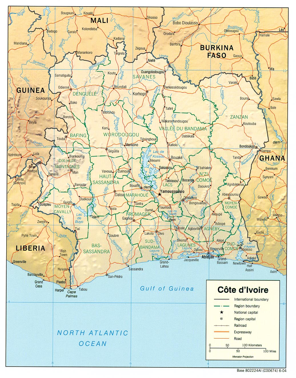
English: haded relief map of Côte d'Ivoire. |
|||
| दिनांक | ||||
| स्रोत | [1] from the Perry-Castañeda Library Map Collection. | |||
| लेखक | CIA | |||
| अनुमति (इस चित्र का पुनः उपयोग करना) |
|

![[1]](http://www.lib.utexas.edu/maps/africa/cote_divoire_rel04.jpg)
चित्र का इतिहास
फ़ाइलका पुराना अवतरण देखने के लिये दिनांक/समय पर क्लिक करें।
| दिनांक/समय | थंबनेल | आकार | सदस्य | प्रतिक्रिया | |
|---|---|---|---|---|---|
| वर्तमान | 11:11, 21 फ़रवरी 2006 | | 1,036 × 1,322 (440 KB) | Lupo | Shaded relief map of Côte d'Ivoire. Source: [http://www.lib.utexas.edu/maps/africa/cote_divoire_rel04.jpg] from the [http://www.lib.utexas.edu/maps/cote_d'ivoire.html Perry-Castañeda Library Map Collection]. {{PD-USGov-CIA}} [[Category:Maps of C� |
चित्र का उपयोग
निम्नलिखित पन्ने इस चित्र से जुडते हैं :
चित्र का वैश्विक उपयोग
इस चित्र का उपयोग इन दूसरे विकियों में किया जाता है:
- als.wikipedia.org पर उपयोग
- ar.wikipedia.org पर उपयोग
- az.wikipedia.org पर उपयोग
- be.wikipedia.org पर उपयोग
- bn.wikipedia.org पर उपयोग
- ca.wikipedia.org पर उपयोग
- ckb.wikipedia.org पर उपयोग
- cv.wikipedia.org पर उपयोग
- de.wikipedia.org पर उपयोग
- en.wikipedia.org पर उपयोग
- es.wikipedia.org पर उपयोग
- fa.wikipedia.org पर उपयोग
- fr.wikipedia.org पर उपयोग
- fr.wikinews.org पर उपयोग
- fy.wikipedia.org पर उपयोग
- gd.wikipedia.org पर उपयोग
- gl.wikipedia.org पर उपयोग
- id.wikipedia.org पर उपयोग
- it.wikipedia.org पर उपयोग
- ka.wikipedia.org पर उपयोग
- kbp.wikipedia.org पर उपयोग
- kk.wikipedia.org पर उपयोग
- lfn.wikipedia.org पर उपयोग
- mzn.wikipedia.org पर उपयोग
- nl.wikipedia.org पर उपयोग
- pl.wikipedia.org पर उपयोग
- ru.wikipedia.org पर उपयोग
- sa.wikipedia.org पर उपयोग
- ta.wikipedia.org पर उपयोग
इस चित्र के वैश्विक उपयोग की अधिक जानकारी देखें।