चित्र:GPS Satellite NASA art-iif.jpg

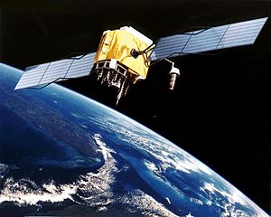
इस पूर्वावलोकन का आकार: 748 × 599 पिक्सेल। दूसरे रेसोल्यूशन्स: 300 × 240 पिक्सेल | 599 × 480 पिक्सेल | 1,006 × 806 पिक्सेल।
मूल चित्र ((1,006 × 806 पिक्सेल, फ़ाइल का आकार: 111 KB, MIME प्रकार: image/jpeg))
|
|
यह फ़ाइल विकिमेडिया कॉमन्स से है। वहाँ पर इसका विवरण पृष्ठ निम्नोक्त है। कॉमन्स मुक्त लाइसेंसों के अंतर्गत उपलब्ध मीडिया फ़ाइलों का संग्रह है। आप भी इसमें मदद कर सकते हैं। |
सारांश
| विवरण |
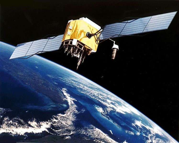
English: Artist's conception of GPS Block II-F satellite in Earth orbit.
Français : Vue d'artiste d'un satellite GPS Block II-F sur orbite terrestre. |
| दिनांक | अज्ञात तारीख |
| स्रोत | https://www.egraphicbd.com [मृत कड़ी] (Wayback Machine) |
| लेखक | NASA |
| दूसरे संस्करण |

लाइसेंस
| This file is in the public domain in the United States because it was solely created by NASA. NASA copyright policy states that "NASA material is not protected by copyright unless noted". (See Template:PD-USGov, NASA copyright policy page or JPL Image Use Policy.) | ||
 |
Warnings:
|
चित्र का इतिहास
फ़ाइलका पुराना अवतरण देखने के लिये दिनांक/समय पर क्लिक करें।
| दिनांक/समय | थंबनेल | आकार | सदस्य | प्रतिक्रिया | |
|---|---|---|---|---|---|
| वर्तमान | 20:20, 9 फ़रवरी 2006 | | 1,006 × 806 (111 KB) | Michaelfavor~commonswiki | Artist Interpretation of GPS satellite, image courtesy of NASA http://www.navcen.uscg.gov/ftp/gps/ggeninfo/gps-iif.tif |
चित्र का उपयोग
निम्नलिखित पन्ने इस चित्र से जुडते हैं :
चित्र का वैश्विक उपयोग
इस चित्र का उपयोग इन दूसरे विकियों में किया जाता है:
- af.wikipedia.org पर उपयोग
- ar.wikipedia.org पर उपयोग
- ba.wikipedia.org पर उपयोग
- be.wikipedia.org पर उपयोग
- bn.wikipedia.org पर उपयोग
- cs.wikipedia.org पर उपयोग
- cv.wikipedia.org पर उपयोग
- da.wikipedia.org पर उपयोग
- de.wikinews.org पर उपयोग
- el.wikipedia.org पर उपयोग
- en.wikipedia.org पर उपयोग
- Navigation
- Dynamic positioning
- Geoinformatics
- Militarisation of space
- GPS signals
- Wikipedia:WikiProject Systems/List of images of systems
- Talk:USA-193
- Help talk:Table/Archive 3
- List of equipment of the United States Armed Forces
- Error analysis for the Global Positioning System
- User:Doggitydogs/GPS
- User:HelpingWorld/sandbox2
- User:Wikiworkr/sandbox
- User:MYBOIIII/sandbox
- Portal:Geodesy
- en.wikibooks.org पर उपयोग
- en.wikiversity.org पर उपयोग
- es.wikipedia.org पर उपयोग
- es.wikinews.org पर उपयोग
- et.wikipedia.org पर उपयोग
- fa.wikipedia.org पर उपयोग
- fi.wikipedia.org पर उपयोग
- fr.wikipedia.org पर उपयोग
इस चित्र के वैश्विक उपयोग की अधिक जानकारी देखें।