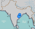
चित्र:Kalinga.GIF
Kalinga.GIF ((400 × 337 पिक्सेल, फ़ाइल का आकार: 10 KB, MIME प्रकार: image/gif))
चित्र का इतिहास
फ़ाइलका पुराना अवतरण देखने के लिये दिनांक/समय पर क्लिक करें।
| दिनांक/समय | थंबनेल | आकार | सदस्य | प्रतिक्रिया | |
|---|---|---|---|---|---|
| वर्तमान | 22:46, 13 दिसम्बर 2006 |  | 400 × 337 (10 KB) | Electionworld | {{ew|en|Deepak gupta}} ==Licensing== {{PD-user|Deepak gupta}} Used [http://www.proel.org/alfabetos/dravidi.html http://www.proel.org/alfabetos/dravidi.html] as a reference |
चित्र का उपयोग
निम्नलिखित पन्ने इस चित्र से जुडते हैं :
चित्र का वैश्विक उपयोग
इस चित्र का उपयोग इन दूसरे विकियों में किया जाता है:
- bn.wikipedia.org पर उपयोग
- ca.wikipedia.org पर उपयोग
- de.wikipedia.org पर उपयोग
- en.wikipedia.org पर उपयोग
- fi.wikipedia.org पर उपयोग
- fr.wikipedia.org पर उपयोग
- it.wikipedia.org पर उपयोग
- ja.wikipedia.org पर उपयोग
- ka.wikipedia.org पर उपयोग
- ko.wikipedia.org पर उपयोग
- la.wikipedia.org पर उपयोग
- ml.wikipedia.org पर उपयोग
- mr.wikipedia.org पर उपयोग
- nl.wikipedia.org पर उपयोग
- or.wikipedia.org पर उपयोग
- pt.wikipedia.org पर उपयोग
- ru.wikipedia.org पर उपयोग
- sq.wikipedia.org पर उपयोग
- ta.wikipedia.org पर उपयोग
- uk.wikipedia.org पर उपयोग
- www.wikidata.org पर उपयोग
- xmf.wikipedia.org पर उपयोग
- zh.wikipedia.org पर उपयोग


