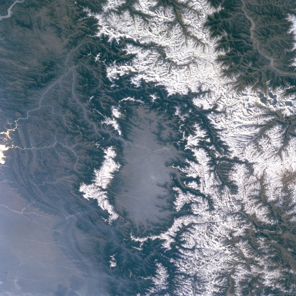
चित्र:Kashmir-sat-nasa.jpg

इस पूर्वावलोकन का आकार: 600 × 600 पिक्सेल। दूसरे रेसोल्यूशन्स: 240 × 240 पिक्सेल | 480 × 480 पिक्सेल | 640 × 640 पिक्सेल।
मूल चित्र ((640 × 640 पिक्सेल, फ़ाइल का आकार: 428 KB, MIME प्रकार: image/jpeg))
चित्र का इतिहास
फ़ाइलका पुराना अवतरण देखने के लिये दिनांक/समय पर क्लिक करें।
| दिनांक/समय | थंबनेल | आकार | सदस्य | प्रतिक्रिया | |
|---|---|---|---|---|---|
| वर्तमान | 15:45, 17 मई 2011 |  | 640 × 640 (428 KB) | Woudloper | {{Information |Description={{en|Public domain NASA image: http://eol.jsc.nasa.gov/sseop/EFS/images.pl?photo=STS066-127-79}} |Source=Transferred from [http://en.wikipedia.org en.wikipedia] |Date={{Date|2009|04|01}} (original upload date) |Author=Original u |
चित्र का उपयोग
निम्नलिखित पन्ने इस चित्र से जुडते हैं :
चित्र का वैश्विक उपयोग
इस चित्र का उपयोग इन दूसरे विकियों में किया जाता है:
- ar.wikipedia.org पर उपयोग
- be.wikipedia.org पर उपयोग
- bh.wikipedia.org पर उपयोग
- bn.wikipedia.org पर उपयोग
- de.wikipedia.org पर उपयोग
- de.wikivoyage.org पर उपयोग
- dty.wikipedia.org पर उपयोग
- en.wikipedia.org पर उपयोग
- en.wikivoyage.org पर उपयोग
- es.wikipedia.org पर उपयोग
- fa.wikipedia.org पर उपयोग
- frr.wikipedia.org पर उपयोग
- fr.wikipedia.org पर उपयोग
- fr.wikinews.org पर उपयोग
- fr.wikivoyage.org पर उपयोग
- gu.wikipedia.org पर उपयोग
- he.wikipedia.org पर उपयोग
- id.wikipedia.org पर उपयोग
- ja.wikipedia.org पर उपयोग
- kn.wikipedia.org पर उपयोग
- ko.wikipedia.org पर उपयोग
- ks.wikipedia.org पर उपयोग
- ml.wikipedia.org पर उपयोग
- mr.wikipedia.org पर उपयोग
- ms.wikipedia.org पर उपयोग
- ne.wikipedia.org पर उपयोग
- nl.wikipedia.org पर उपयोग
- nn.wikipedia.org पर उपयोग
- os.wikipedia.org पर उपयोग
- pa.wikipedia.org पर उपयोग
- pl.wikipedia.org पर उपयोग
- pnb.wikipedia.org पर उपयोग
- ru.wikipedia.org पर उपयोग
- ru.wikinews.org पर उपयोग
- sa.wikipedia.org पर उपयोग
- simple.wikipedia.org पर उपयोग
- sl.wikipedia.org पर उपयोग
- sv.wikipedia.org पर उपयोग
इस चित्र के वैश्विक उपयोग की अधिक जानकारी देखें।

