चित्र:Kathiawar map.jpg
इस पूर्वावलोकन का आकार: 800 × 548 पिक्सेल। दूसरे रेसोल्यूशन्स: 320 × 219 पिक्सेल | 640 × 438 पिक्सेल | 1,024 × 701 पिक्सेल | 1,280 × 877 पिक्सेल | 2,492 × 1,707 पिक्सेल।
मूल चित्र ((2,492 × 1,707 पिक्सेल, फ़ाइल का आकार: 2.87 MB, MIME प्रकार: image/jpeg))
|
|
यह फ़ाइल विकिमेडिया कॉमन्स से है। वहाँ पर इसका विवरण पृष्ठ निम्नोक्त है। कॉमन्स मुक्त लाइसेंसों के अंतर्गत उपलब्ध मीडिया फ़ाइलों का संग्रह है। आप भी इसमें मदद कर सकते हैं। |
सारांश
| Description |
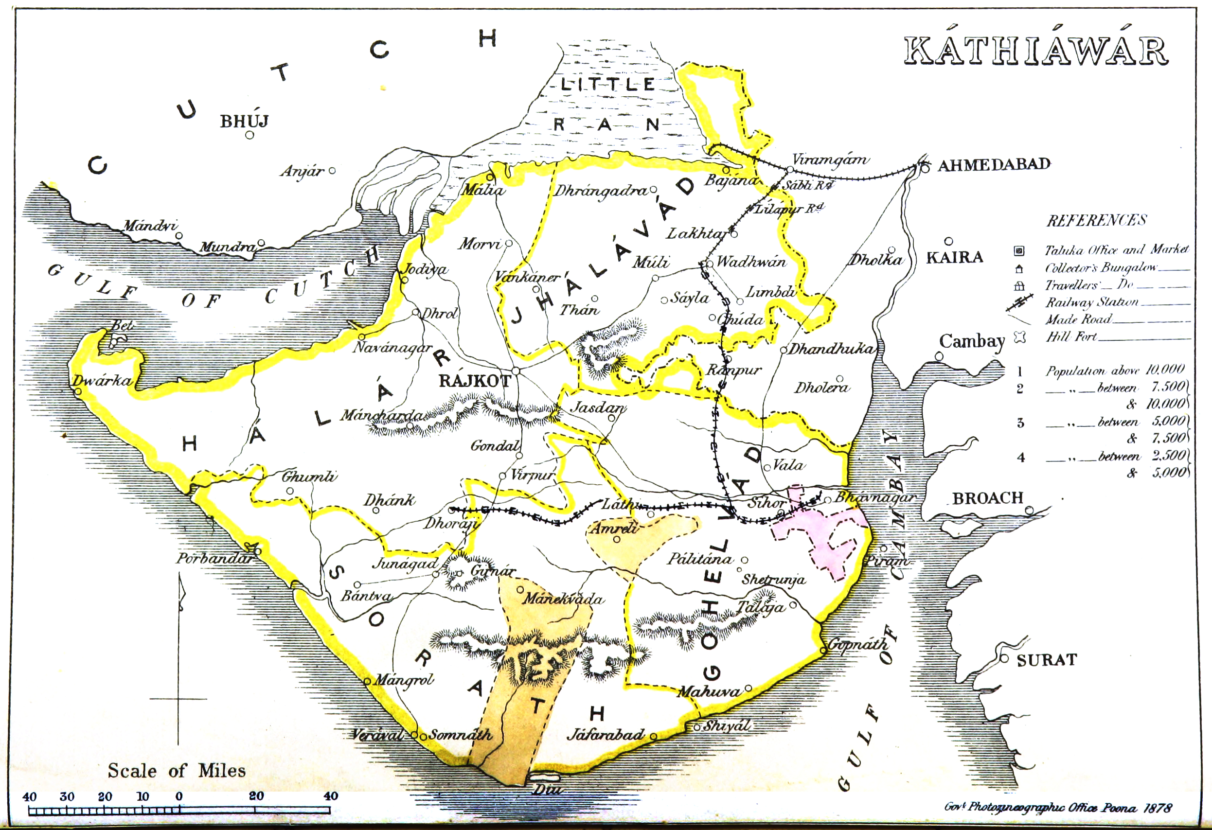
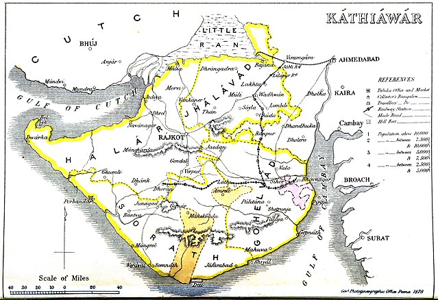
English: Map of Kathiawar |
|||||||||
| दिनांक | ||||||||||
| स्रोत | Gazetteer of the Bombay Presidency. (1896) by James M. Campbell | |||||||||
| रचियता |
Various |
|||||||||
| Geotemporal data | ||||||||||
| Bounding box |
|
|||||||||
| Georeferencing | ||||||||||
लाइसेंस
|
This work is in the public domain in its country of origin and other countries and areas where the copyright term is the author's life plus 70 years or fewer. This work is in the public domain in the United States because it was published (or registered with the U.S. Copyright Office) before January 1, 1929. | |
| इस फ़ाइल को कॉपीराइट कानूनों के अंतर्गत सभी संबंधित अधिकारों समेत ज्ञात सीमाओं से मुक्त पहचाना गया है। | |
चित्र का इतिहास
फ़ाइलका पुराना अवतरण देखने के लिये दिनांक/समय पर क्लिक करें।
| दिनांक/समय | थंबनेल | आकार | सदस्य | प्रतिक्रिया | |
|---|---|---|---|---|---|
| वर्तमान | 15:19, 5 नवम्बर 2014 | | 2,492 × 1,707 (2.87 MB) | Shyamal | User created page with UploadWizard |
चित्र का उपयोग
इस चित्र से कोई पन्ने नहीं जुड़ते
चित्र का वैश्विक उपयोग
इस चित्र का उपयोग इन दूसरे विकियों में किया जाता है:
- bn.wikipedia.org पर उपयोग
- ca.wikipedia.org पर उपयोग
- de.wikipedia.org पर उपयोग
- en.wikipedia.org पर उपयोग
- gu.wikipedia.org पर उपयोग
- kn.wikipedia.org पर उपयोग
- ta.wikipedia.org पर उपयोग
- ur.wikipedia.org पर उपयोग
- www.wikidata.org पर उपयोग