चित्र:Kotayk.svg

पूर्वावलोकन PNG का आकार SVG फ़ाइल: 587 × 599 पिक्सेल दूसरे रेसोल्यूशन्स: 235 × 240 पिक्सेल | 470 × 480 पिक्सेल | 752 × 768 पिक्सेल | 1,003 × 1,024 पिक्सेल | 2,006 × 2,048 पिक्सेल | 725 × 740 पिक्सेल।
मूल चित्र (SVG फ़ाइल, साधारणतः 725 × 740 पिक्सेल, फ़ाइल का आकार: 72 KB)
|
|
यह फ़ाइल विकिमेडिया कॉमन्स से है। वहाँ पर इसका विवरण पृष्ठ निम्नोक्त है। कॉमन्स मुक्त लाइसेंसों के अंतर्गत उपलब्ध मीडिया फ़ाइलों का संग्रह है। आप भी इसमें मदद कर सकते हैं। |
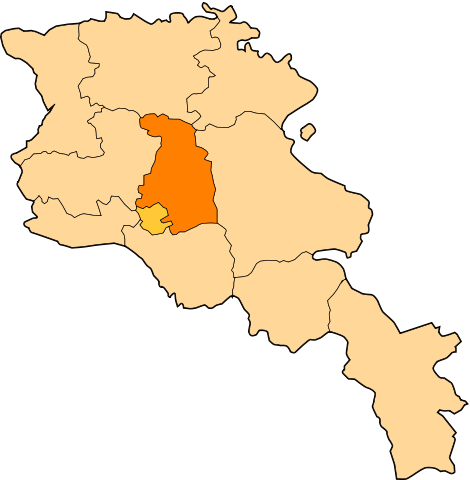
| विवरण | Image shows the eleven administrative subdivisions of Armenia: # Aragatsotn (Արագածոտնի) # Ararat (Արարատի) # Armavir (Արմավիրի) # Gegharkunik (Գեղարքունիքի) # Kotayk (Կոտայքի) # Lori (Լոռու) # Shirak (Շիրակի) # Syunik (Սյունիքի) # Tavush (Տավուշի) # Vayots Dzor (Վայոց Ձորի) # Yerevan (Երևան) - special administrative status Derived from a multiple of public sources and created using Inkscape. == |
| दिनांक | (UTC) |
| स्रोत | |
| लेखक |
|
| This is a retouched picture, which means that it has been digitally altered from its original version. Modifications: Creation d'une autre map. The original can be viewed here: Armenia map numbered.svg:
|
इस फ़ाइल को क्रिएटिव कॉमन्स श्रेय-समानसांझा 3.0 अनरिपोर्टेड लाइसेंस के अंतर्गत लाइसेंस किया गया है।
- आप खुलकर:
- बाँट सकते हैं – रचना की प्रतिलिपि बना सकते हैं, बाँँट सकते हैं और संचारित कर सकते हैं
- रीमिक्स कर सकते हैं – कार्य को अनुकूलित कर सकते हैं
- निम्नलिखित शर्तों के अंतर्गत:
- श्रेय – यह अनिवार्य है कि आप यथोचित श्रेय प्रदान करें, लाइसेंस की कड़ी प्रदान करें, और अगर कोई बदलाव हुए हों तो उन्हें इंगित करें। आप ऐसा किसी भी उचित तरीके से कर सकते हैं, लेकिन किसी भी तरह उससे यह नहीं संकेत नहीं किया जाना चाहिए कि लाइसेंसधारी द्वारा आपको अथवा आपके इस प्रयोग का समर्थन किया जा रहा हो।
- समानसांझा – अगर आप इस रचना में कोई बदलाव करते हैं या इसपर आधारित कुछ रचित करते हैं तो आप अपने योगदान को सिर्फ इसी या इसके सामान किसी लाइसेंस के अंतर्गत बाँट सकते हैं।
मूल अपलोड लॉग
This image is a derivative work of the following images:
- File:Armenia_map_numbered.svg licensed with Cc-by-sa-3.0-migrated, GFDL
- 2010-09-26T17:27:10Z 6AND5 725x740 (82221 Bytes) Reverted to version as of 17:31, 25 November 2006 (((Exclaves deleted according to official map at http://www.gov.am/en/regions/)))
- 2006-11-25T19:37:43Z Bastique 725x740 (87638 Bytes) Cleanup
- 2006-11-25T19:26:57Z Bastique 725x740 (86083 Bytes) Enclaves
- 2006-11-25T17:31:38Z Bastique 725x740 (82221 Bytes) Fixed canvas size
- 2006-11-25T17:27:59Z Bastique 744x1052 (79767 Bytes) Image shows the subdivisions of Armenia. Derived from a multiple of public sources and created using Inkscape. == Licensing == {{GFDL}} Image shows the eleven administrative subdivisions of Armenia: #[[Aragatsotn]] (Ար�
Uploaded with derivativeFX
चित्र का इतिहास
फ़ाइलका पुराना अवतरण देखने के लिये दिनांक/समय पर क्लिक करें।
| दिनांक/समय | थंबनेल | आकार | सदस्य | प्रतिक्रिया | |
|---|---|---|---|---|---|
| वर्तमान | 11:20, 30 दिसम्बर 2010 | | 725 × 740 (72 KB) | Varmin | {{Information |Description=Image shows the eleven administrative subdivisions of Armenia: # Aragatsotn (Արագածոտնի) # Ararat (Արարատի) # Armavir (Արմավիրի) # Gegharkunik (Գեղ |
चित्र का उपयोग
निम्नलिखित पन्ने इस चित्र से जुडते हैं :
चित्र का वैश्विक उपयोग
इस चित्र का उपयोग इन दूसरे विकियों में किया जाता है:
- ar.wikipedia.org पर उपयोग
- be.wikipedia.org पर उपयोग
- bg.wikipedia.org पर उपयोग
- ceb.wikipedia.org पर उपयोग
- ce.wikipedia.org पर उपयोग
इस चित्र के वैश्विक उपयोग की अधिक जानकारी देखें।