चित्र:Location Tumen-River.png
इससे बड़ा रेसोल्यूशन उपलब्ध नहीं हैं।
Location_Tumen-River.png ((489 × 337 पिक्सेल, फ़ाइल का आकार: 111 KB, MIME प्रकार: image/png))
|
|
यह फ़ाइल विकिमेडिया कॉमन्स से है। वहाँ पर इसका विवरण पृष्ठ निम्नोक्त है। कॉमन्स मुक्त लाइसेंसों के अंतर्गत उपलब्ध मीडिया फ़ाइलों का संग्रह है। आप भी इसमें मदद कर सकते हैं। |
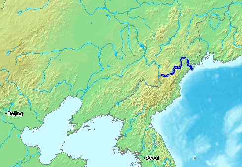
English: The Tumen River is a long river that serves as part of the boundary between China, North Korea, and the Russian Federation.
- Русский: ru:Туманная (река) - река на Дальнем Востоке, по которой проходят границы России, КНДР и Китая.
This image is in the public domain because it came from the site https://www.demis.nl/products/web-map-server/examples/ and was released by the copyright holder. Permission is granted to copy, distribute and/or modify this map since it is based on free of copyright images from: www.demis.nl. See also approval email on de.wp and its clarification.
|
| This work has been released into the public domain by its copyright holder, www.demis.nl. This applies worldwide. कुछ देशों में यह कानूनी तौर पर नहीं हो सकता है; ऐसा हो तो: www.demis.nl सभी को इस कार्य का इस्तेमाल किसी भी उद्देश्य से, बिना किसी बाधाओं के इन शर्तों के कानून द्वारा अनिवार्य किए तक करने की अनुमति देता/देती हैं।
|
चित्र का इतिहास
फ़ाइलका पुराना अवतरण देखने के लिये दिनांक/समय पर क्लिक करें।
| दिनांक/समय | थंबनेल | आकार | सदस्य | प्रतिक्रिया | |
|---|---|---|---|---|---|
| वर्तमान | 15:16, 13 जनवरी 2007 | | 489 × 337 (111 KB) | Kaba | en:Tumen River is a long river that serves as part of the boundary between en:China, en:North Korea, and the [:en:Russian Federation|]]. ja:豆満江はは中朝国境のja:白頭山に源流を発し、ja:中国、[[:ja |
चित्र का उपयोग
निम्नलिखित पन्ने इस चित्र से जुडते हैं :
चित्र का वैश्विक उपयोग
इस चित्र का उपयोग इन दूसरे विकियों में किया जाता है:
- af.wikipedia.org पर उपयोग
- ar.wikipedia.org पर उपयोग
- azb.wikipedia.org पर उपयोग
- bn.wikipedia.org पर उपयोग
- br.wikipedia.org पर उपयोग
- ckb.wikipedia.org पर उपयोग
- cs.wikipedia.org पर उपयोग
- de.wikipedia.org पर उपयोग
- en.wikipedia.org पर उपयोग
- en.wikinews.org पर उपयोग
- es.wikipedia.org पर उपयोग
- fa.wikipedia.org पर उपयोग
- fi.wikipedia.org पर उपयोग
- fi.wikinews.org पर उपयोग
- fr.wikipedia.org पर उपयोग
- he.wikipedia.org पर उपयोग
- hu.wikipedia.org पर उपयोग
- id.wikipedia.org पर उपयोग
- it.wikipedia.org पर उपयोग
- ja.wikipedia.org पर उपयोग
- jv.wikipedia.org पर उपयोग
- ko.wikipedia.org पर उपयोग
- mk.wikipedia.org पर उपयोग
- ml.wikipedia.org पर उपयोग
- mn.wikipedia.org पर उपयोग
- nl.wikipedia.org पर उपयोग
- nn.wikipedia.org पर उपयोग
- no.wikipedia.org पर उपयोग
- oc.wikipedia.org पर उपयोग
- pa.wikipedia.org पर उपयोग
- pl.wikipedia.org पर उपयोग
- pnb.wikipedia.org पर उपयोग
- pt.wikipedia.org पर उपयोग
- ru.wikipedia.org पर उपयोग
- sh.wikipedia.org पर उपयोग
- sv.wikipedia.org पर उपयोग
- th.wikipedia.org पर उपयोग
- vi.wikipedia.org पर उपयोग
- zh-min-nan.wikipedia.org पर उपयोग
- zh-yue.wikipedia.org पर उपयोग
इस चित्र के वैश्विक उपयोग की अधिक जानकारी देखें।