चित्र:Map-antarctica-ross-ice-shelf-red-x.png
इससे बड़ा रेसोल्यूशन उपलब्ध नहीं हैं।
Map-antarctica-ross-ice-shelf-red-x.png ((316 × 313 पिक्सेल, फ़ाइल का आकार: 26 KB, MIME प्रकार: image/png))
|
|
यह फ़ाइल विकिमेडिया कॉमन्स से है। वहाँ पर इसका विवरण पृष्ठ निम्नोक्त है। कॉमन्स मुक्त लाइसेंसों के अंतर्गत उपलब्ध मीडिया फ़ाइलों का संग्रह है। आप भी इसमें मदद कर सकते हैं। |
| विवरण |
|
| दिनांक | (UTC) |
| स्रोत | |
| लेखक |
|
| दूसरे संस्करण | Derivative works of this file: Antarctica map indicating Antarctic Peninsula.JPG |
| This is a retouched picture, which means that it has been digitally altered from its original version. Modifications: Cropped, put in red X on the Ross ice shelf.. The original can be viewed here: Antarctica Map.png:
|
This image is in the public domain because it contains materials that originally came from the United States Central Intelligence Agency's World Factbook.
|
 |
मूल अपलोड लॉग
This image is a derivative work of the following images:
- File:Antarctica_Map.png licensed with PD-USGov-CIA-WF
- 2004-12-15T23:16:35Z Mschlindwein 502x617 (53433 Bytes)
Uploaded with derivativeFX
चित्र का इतिहास
फ़ाइलका पुराना अवतरण देखने के लिये दिनांक/समय पर क्लिक करें।
| दिनांक/समय | थंबनेल | आकार | सदस्य | प्रतिक्रिया | |
|---|---|---|---|---|---|
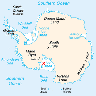
| वर्तमान | 17:22, 16 फ़रवरी 2009 | | 316 × 313 (26 KB) | Jeandré du Toit | {{Information |Description=*Map of Antarctica with a red X on the Ross ice shelf. |Source=*File:Antarctica_Map.png |Date=2009-02-16 17:20 (UTC) |Author=*File:Antarctica_Map.png *derivative work: ~~~ |Permission=see below |other_versions= }} { |
चित्र का उपयोग
इस चित्र से कोई पन्ने नहीं जुड़ते
चित्र का वैश्विक उपयोग
इस चित्र का उपयोग इन दूसरे विकियों में किया जाता है:
- en.wikipedia.org पर उपयोग
- fi.wikipedia.org पर उपयोग
- gv.wikipedia.org पर उपयोग
- id.wikipedia.org पर उपयोग
- ja.wikipedia.org पर उपयोग
- mk.wikipedia.org पर उपयोग
- ms.wikipedia.org पर उपयोग
- pt.wikipedia.org पर उपयोग
- zh.wikipedia.org पर उपयोग