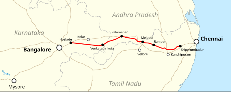
चित्र:Map Bengaluru-Chennai Expressway.svg

पूर्वावलोकन PNG का आकार SVG फ़ाइल: 800 × 319 पिक्सेल दूसरे रेसोल्यूशन्स: 320 × 128 पिक्सेल | 640 × 255 पिक्सेल | 1,024 × 408 पिक्सेल | 1,280 × 510 पिक्सेल | 2,560 × 1,020 पिक्सेल | 911 × 363 पिक्सेल।
मूल चित्र (SVG फ़ाइल, साधारणतः 911 × 363 पिक्सेल, फ़ाइल का आकार: 121 KB)
चित्र का इतिहास
फ़ाइलका पुराना अवतरण देखने के लिये दिनांक/समय पर क्लिक करें।
| दिनांक/समय | थंबनेल | आकार | सदस्य | प्रतिक्रिया | |
|---|---|---|---|---|---|
| वर्तमान | 01:59, 3 जनवरी 2020 | 911 × 363 (121 KB) | Pechristener | {{Information |description={{en|Location map of the Bengaluru-Chennai Expressway}} |date=2020-01-02 |source=Map was created using: * [https://www.naturalearthdata.com Natural Earth] for 1:10m Cultural Vectors used for Country Borders & Major Roads |author= * Natural Earth: Tom Patterson, Nathaniel Vaughn Kelso and other contributors * Map rendering: Pechristener using [https://qgis.org QGIS] |permission={{Cc-zero}} |other versions= }} Category:Road maps of India |
चित्र का उपयोग
निम्नलिखित पन्ने इस चित्र से जुडते हैं :
चित्र का वैश्विक उपयोग
इस चित्र का उपयोग इन दूसरे विकियों में किया जाता है:
- bn.wikipedia.org पर उपयोग
- de.wikipedia.org पर उपयोग
- en.wikipedia.org पर उपयोग
- te.wikipedia.org पर उपयोग