मूल चित्र((787 × 799 पिक्सेल, फ़ाइल का आकार: 352 KB, MIME प्रकार: image/png))

सारांश

विवरण
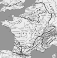
Afrikaans: Romeinse provinsies en stamgroepe van die Galliese gebied in die laat 1ste eeu v.C.
Ελληνικά: Χάρτης της Γαλατίας και των κελτικών φυλών τον 1ο αιώνα π.Χ.
Français : Provinces romaines et les peuples proto-basques, celtes et germanique à la fin du Ier siècle av. J-C.
English: Roman provinces and the proto-Basque, Celtic and Germanic peoples at the end of the 1st century BC. J-C.
दिनांक
स्रोत अपना कार्य
लेखक User:Feitscherg
दूसरे संस्करण

Derivative works of this file:

This historical map image could be re-created using vector graphics as an SVG file. This has several advantages; see Commons:Media for cleanup for more information. If an SVG form of this image is available, please upload it and afterwards replace this template with {{vector version available|new image name}}.


It is recommended to name the SVG file “Map Gallia Tribes Towns.svg”—then the template Vector version available (or Vva) does not need the new image name parameter.

लाइसेंस

मैं, इस कार्य का/की कॉपीराइट धारक, इसे निम्न लाइसेंस के अंतर्गत प्रकाशित करता/करती हूँ:
GNU head इस दस्तावेज़ को Free Software Foundation द्वारा प्रकाशित GNU मुक्त प्रलेख लाइसेंस के संस्करण 1.2 या नए (बिना किसी अपरिवर्तनीय अनुभागों और अगले या पिछले आवरण के टेक्स्ट के) के अंतर्गत प्रतिलिपि बनाने, बाँटने और/या बदलने की अनुमति प्रदान की जाती है। इस लाइसेंस की एक प्रतिलिपि GNU मुक्त प्रलेख लाइसेंस नामक अनुभाग में शामिल है।
w:hi:क्रिएटिव कॉमन्स
श्रेय समानसांझा
इस फ़ाइल को क्रिएटिव कॉमन्स श्रेय-समानसांझा 3.0 अनरिपोर्टेड लाइसेंस के अंतर्गत लाइसेंस किया गया है।
आप खुलकर:
  • बाँट सकते हैं – रचना की प्रतिलिपि बना सकते हैं, बाँँट सकते हैं और संचारित कर सकते हैं
  • रीमिक्स कर सकते हैं – कार्य को अनुकूलित कर सकते हैं
निम्नलिखित शर्तों के अंतर्गत:
  • श्रेय – यह अनिवार्य है कि आप यथोचित श्रेय प्रदान करें, लाइसेंस की कड़ी प्रदान करें, और अगर कोई बदलाव हुए हों तो उन्हें इंगित करें। आप ऐसा किसी भी उचित तरीके से कर सकते हैं, लेकिन किसी भी तरह उससे यह नहीं संकेत नहीं किया जाना चाहिए कि लाइसेंसधारी द्वारा आपको अथवा आपके इस प्रयोग का समर्थन किया जा रहा हो।
  • समानसांझा – अगर आप इस रचना में कोई बदलाव करते हैं या इसपर आधारित कुछ रचित करते हैं तो आप अपने योगदान को सिर्फ इसी या इसके सामान किसी लाइसेंस के अंतर्गत बाँट सकते हैं।
This licensing tag was added to this file as part of the GFDL licensing update.

Captions

Add a one-line explanation of what this file represents
Map of Gaul in the 1st century BCE, showing the relative positions of the Celtic tribes.

Items portrayed in this file

चित्रण

source of file अंग्रेज़ी

original creation by uploader अंग्रेज़ी

MIME type अंग्रेज़ी

image/png

चित्र का इतिहास

फ़ाइलका पुराना अवतरण देखने के लिये दिनांक/समय पर क्लिक करें।

दिनांक/समयथंबनेलआकारसदस्यप्रतिक्रिया
वर्तमान19:43, 23 मई 201419:43, 23 मई 2014 के संस्करण का थंबनेल संस्करण787 × 799 (352 KB)ZorionTwo aquitanian tribes added. Volcates replaced by Vasates
23:01, 14 जनवरी 200523:01, 14 जनवरी 2005 के संस्करण का थंबनेल संस्करण787 × 799 (169 KB)FeitschergMap of Gallia (54 BC) with Tribes, Towns, Rivers etc. labeled; selfmade {{GFDL}}

निम्नलिखित पन्ने इस चित्र से जुडते हैं :

चित्र का वैश्विक उपयोग

इस चित्र का उपयोग इन दूसरे विकियों में किया जाता है:

इस चित्र के वैश्विक उपयोग की अधिक जानकारी देखें।

मेटाडेटा