चित्र:Map South Korea de.png
इस पूर्वावलोकन का आकार: 522 × 600 पिक्सेल। दूसरे रेसोल्यूशन्स: 209 × 240 पिक्सेल | 591 × 679 पिक्सेल।
मूल चित्र ((591 × 679 पिक्सेल, फ़ाइल का आकार: 59 KB, MIME प्रकार: image/png))
|
|
यह फ़ाइल विकिमेडिया कॉमन्स से है। वहाँ पर इसका विवरण पृष्ठ निम्नोक्त है। कॉमन्स मुक्त लाइसेंसों के अंतर्गत उपलब्ध मीडिया फ़ाइलों का संग्रह है। आप भी इसमें मदद कर सकते हैं। |
सारांश
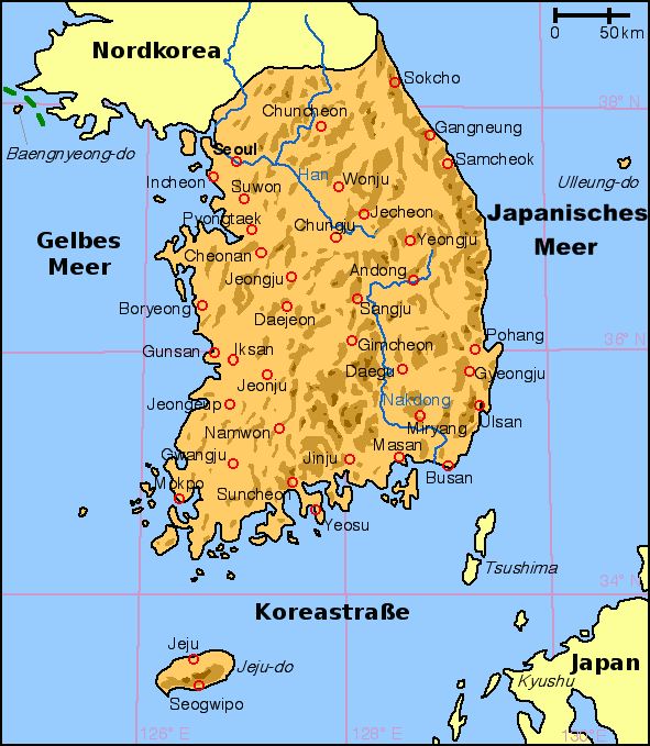
English: Map of South Korea with German labels
Deutsch: Karte von Südkorea mit deutscher Beschriftung
English: Other versions: Image:Map South Korea blank.png
English: From en:Image:Korea south map.png, created by en:User:Kokiri (small modifications by myself).
लाइसेंस
| इस फ़ाइल को क्रिएटिव कॉमन्स श्रेय-समानसांझा 3.0 अनरिपोर्टेड लाइसेंस के अंतर्गत लाइसेंस किया गया है। Subject to disclaimers. | ||
| ||
| This licensing tag was added to this file as part of the GFDL licensing update. |

|
इस दस्तावेज़ को Free Software Foundation द्वारा प्रकाशित GNU मुक्त प्रलेख लाइसेंस के संस्करण 1.2 या नए (बिना किसी अपरिवर्तनीय अनुभागों और अगले या पिछले आवरण के टेक्स्ट के) के अंतर्गत प्रतिलिपि बनाने, बाँटने और/या बदलने की अनुमति प्रदान की जाती है। इस लाइसेंस की एक प्रतिलिपि GNU मुक्त प्रलेख लाइसेंस नामक अनुभाग में शामिल है। Subject to disclaimers. |
चित्र का इतिहास
फ़ाइलका पुराना अवतरण देखने के लिये दिनांक/समय पर क्लिक करें।
| दिनांक/समय | थंबनेल | आकार | सदस्य | प्रतिक्रिया | |
|---|---|---|---|---|---|
| वर्तमान | 20:25, 26 जनवरी 2009 | | 591 × 679 (59 KB) | Valentim | Namensdarstellung des Japanischen Meeres aufgrund w:de:Wikipedia:Namensgebung#Anderssprachige_Gebiete geändert. |
| 17:00, 10 नवम्बर 2008 |  | 591 × 679 (57 KB) | Slomox | ||
| 13:27, 28 नवम्बर 2005 |  | 591 × 679 (29 KB) | IGEL | {{en|Map of South Korea with German labels}} {{de|Karte von Südkorea mit deutscher Beschriftung}} {{en|Other versions: Image:Map South Korea blank.png}} {{en|From en:Image:Korea south map.png, created by en:User:Kokiri (small modification |
चित्र का उपयोग
इस चित्र से कोई पन्ने नहीं जुड़ते
चित्र का वैश्विक उपयोग
इस चित्र का उपयोग इन दूसरे विकियों में किया जाता है:
- de.wikipedia.org पर उपयोग
- de.wikinews.org पर उपयोग
- de.wiktionary.org पर उपयोग