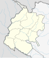
चित्र:Nepal Sudurpashchim Pradesh adm location map.svg

पूर्वावलोकन PNG का आकार SVG फ़ाइल: 502 × 599 पिक्सेल दूसरे रेसोल्यूशन्स: 201 × 240 पिक्सेल | 402 × 480 पिक्सेल | 643 × 768 पिक्सेल | 858 × 1,024 पिक्सेल | 1,715 × 2,048 पिक्सेल | 531 × 634 पिक्सेल।
मूल चित्र (SVG फ़ाइल, साधारणतः 531 × 634 पिक्सेल, फ़ाइल का आकार: 189 KB)
चित्र का इतिहास
फ़ाइलका पुराना अवतरण देखने के लिये दिनांक/समय पर क्लिक करें।
| दिनांक/समय | थंबनेल | आकार | सदस्य | प्रतिक्रिया | |
|---|---|---|---|---|---|
| वर्तमान | 18:39, 5 जनवरी 2022 |  | 531 × 634 (189 KB) | NordNordWest | c |
| 18:07, 5 जनवरी 2022 |  | 531 × 634 (189 KB) | NordNordWest | Kalapani | |
| 06:10, 5 जनवरी 2022 |  | 531 × 577 (168 KB) | C1MM | Reverted to version as of 16:57, 22 March 2020 (UTC) Unable to update relief map while keeping overall relief style the same | |
| 06:08, 5 जनवरी 2022 |  | 886 × 969 (343 KB) | C1MM | Corrected Kalapani disputed territory and rivers | |
| 16:57, 22 मार्च 2020 |  | 531 × 577 (168 KB) | NordNordWest | corr | |
| 20:15, 13 नवम्बर 2018 |  | 531 × 577 (165 KB) | NordNordWest | == {{int:filedesc}} == {{Information |description= {{de|1=Positionskarte von Sudurpashchim Pradesh, Nepal}} {{en|1=Location map of Sudurpashchim Pradesh, Nepal}} {{Location map series N |stretching=114 |top=30.3 |bottom=28.3 |left=79.9 |right=82.0 }} |source={{Own using}} * United States National Imagery and Mapping Agency data |date=2018-11-13 |author={{U|NordNordWest}} |permission= |other_versions=<gallery>Nepal Sudurpashchim Pradesh rel location map.svg</gallery> }} {{Kartenwerkstatt}} ==... |
चित्र का उपयोग
निम्नलिखित पन्ने इस चित्र से जुडते हैं :
चित्र का वैश्विक उपयोग
इस चित्र का उपयोग इन दूसरे विकियों में किया जाता है:
- bh.wikipedia.org पर उपयोग
- bn.wikipedia.org पर उपयोग
- de.wikipedia.org पर उपयोग
- en.wikipedia.org पर उपयोग
- Dhangadhi
- List of districts of Nepal
- Bhimdatta
- Lipulekh Pass
- Mangalsen
- Dasharathchand
- Bhajani
- Gauriganga
- Godawari, Kailali
- Joshipur Rural Municipality
- Mohanyal Rural Municipality
- Tikapur
- Byans, Darchula
- Punarbas
- Kalapani territory
- Sanphebagar
- Lamkichuha
- Jayaprithvi
- Kamalbazar
- Bedkot
- Sudurpashchim Province
- Byans Rural Municipality
- Mahakali, Darchula
- Module:Location map/data/Nepal Sudurpashchim Province
- Module:Location map/data/Nepal Sudurpashchim Province/doc
- Bardagoriya Rural Municipality
- Ghodaghodi
- Kailari Rural Municipality
- Tinkar
- Template:Sudurpashchim Province districts labelled map
- Administration in Sudurpashchim Province
- Bungal Municipality
- Panchadewal Binayak
- Shikhar, Doti
- Purchaudi
- Parshuram, Dadeldhura
- Shailyashikhar
- Apihimal Rural Municipality
- Chure Rural Municipality
- Ganyapadhura Rural Municipality
- Bhageshwar Rural Municipality
- Ajaymeru Rural Municipality
- Naugad Rural Municipality
इस चित्र के वैश्विक उपयोग की अधिक जानकारी देखें।


