चित्र:Planisphæri cœleste.jpg
इस पूर्वावलोकन का आकार: 800 × 547 पिक्सेल। दूसरे रेसोल्यूशन्स: 320 × 219 पिक्सेल | 640 × 437 पिक्सेल | 1,024 × 700 पिक्सेल | 1,280 × 875 पिक्सेल | 2,560 × 1,750 पिक्सेल | 5,812 × 3,972 पिक्सेल।
मूल चित्र ((5,812 × 3,972 पिक्सेल, फ़ाइल का आकार: 19.07 MB, MIME प्रकार: image/jpeg))
|
|
यह फ़ाइल विकिमेडिया कॉमन्स से है। वहाँ पर इसका विवरण पृष्ठ निम्नोक्त है। कॉमन्स मुक्त लाइसेंसों के अंतर्गत उपलब्ध मीडिया फ़ाइलों का संग्रह है। आप भी इसमें मदद कर सकते हैं। |
सारांश
| लेखक |
|
|||||||||||||||||||||||||
| विवरण |
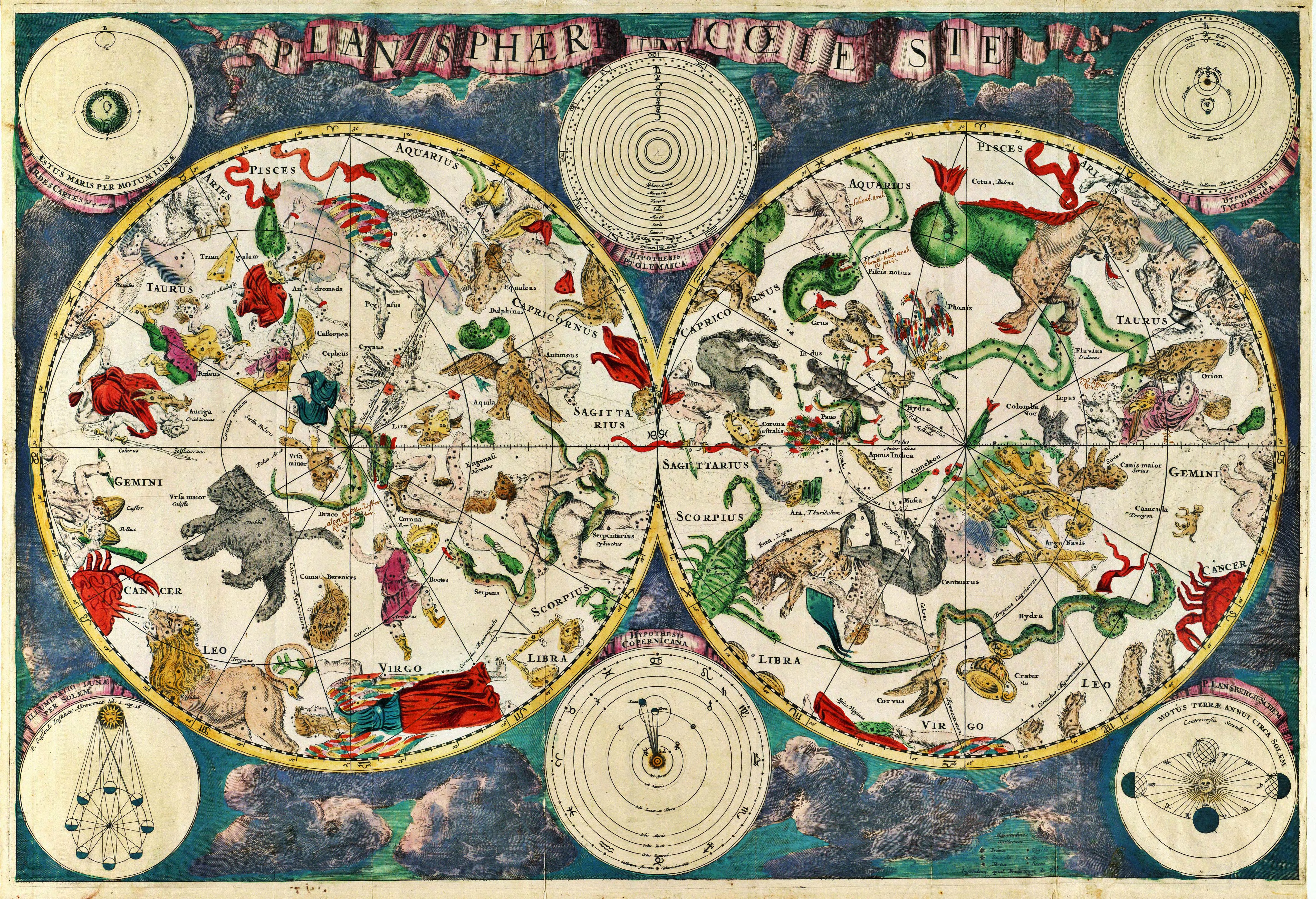
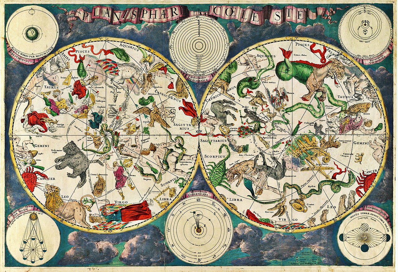
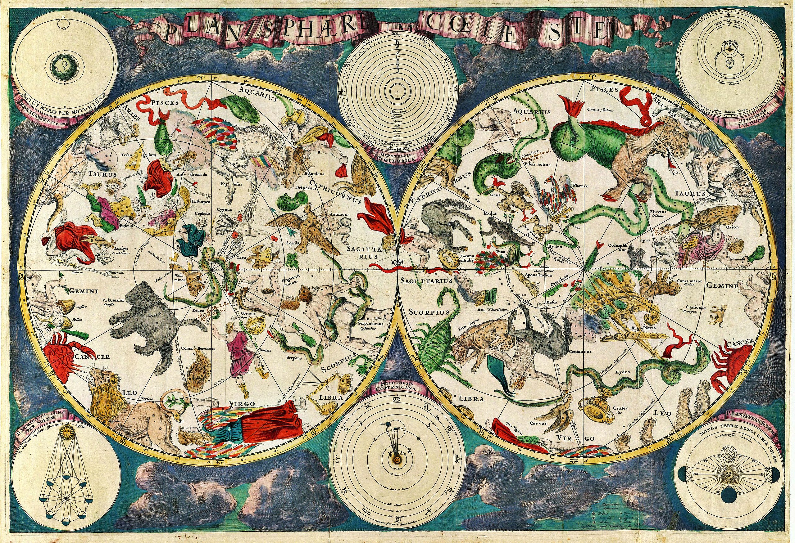
Planisphærium cœleste, denmark, Frederik V English: Celestial map Français : Carte céleste |
|||||||||||||||||||||||||
| दिनांक | १६७० | |||||||||||||||||||||||||
| सन्दर्भ | Koninklijke Deense Bibliotheek | |||||||||||||||||||||||||
| स्रोत/फ़ोटोग्राफ़र | Transferred from en.wikipedia to Commons. Scanned by Janke | |||||||||||||||||||||||||
मूल अपलोड लॉग
The original description page was here. All following user names refer to en.wikipedia.
- 2007-03-10 18:20 Janke 1804×1236×8 (3237455 bytes) Celestial map from the 17th century, by the Dutch cartographer Frederik de Wit. Scanned by uploader
लाइसेंस
|
This is a faithful photographic reproduction of a two-dimensional, public domain work of art. The work of art itself is in the public domain for the following reason:
The official position taken by the Wikimedia Foundation is that "faithful reproductions of two-dimensional public domain works of art are public domain".
This photographic reproduction is therefore also considered to be in the public domain in the United States. In other jurisdictions, re-use of this content may be restricted; see Reuse of PD-Art photographs for details. | ||||
चित्र का इतिहास
फ़ाइलका पुराना अवतरण देखने के लिये दिनांक/समय पर क्लिक करें।
| दिनांक/समय | थंबनेल | आकार | सदस्य | प्रतिक्रिया | |
|---|---|---|---|---|---|
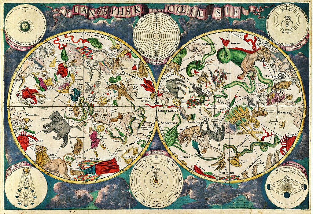
| वर्तमान | 10:01, 23 दिसम्बर 2010 | | 5,812 × 3,972 (19.07 MB) | Joopr | Hogere resolutie |
| 00:18, 29 मई 2007 |  | 1,804 × 1,236 (3.09 MB) | STyx | {{Information |Description= {{la}}Planisphæri cœleste {{en}}Celestial map from the 17th century, by the Dutch cartographer Frederik de Wit. {{fr}}Carte céleste du XVII ème siècle, réalisée par le cartographe hollandais Frederik de Wit. {{du}}[http |
चित्र का उपयोग
निम्नलिखित पन्ने इस चित्र से जुडते हैं :
चित्र का वैश्विक उपयोग
इस चित्र का उपयोग इन दूसरे विकियों में किया जाता है:
- ar.wikipedia.org पर उपयोग
- ar.wikibooks.org पर उपयोग
- ast.wikipedia.org पर उपयोग
- az.wikipedia.org पर उपयोग
- ba.wikipedia.org पर उपयोग
- bg.wikipedia.org पर उपयोग
- bn.wikipedia.org पर उपयोग
- ca.wikipedia.org पर उपयोग
- cbk-zam.wikipedia.org पर उपयोग
- ce.wikipedia.org पर उपयोग
- cs.wikipedia.org पर उपयोग
- de.wikipedia.org पर उपयोग
- el.wikipedia.org पर उपयोग
- en.wikipedia.org पर उपयोग
- Constellation
- Map
- Astronomy
- Natural philosophy
- Star chart
- Wikipedia:Featured picture candidates/March-2007
- Wikipedia:Featured picture candidates/17th century star map
- User:Sj/olpc dictionary images/500
- Portal:Maps/Maps/Historical
- Portal:Maps/Maps/Historical/7
- Talk:Astronomy/Archive 2
- Wikipedia:Wikipedia Signpost/2013-01-14/WikiProject report
- Wikipedia:Wikipedia Signpost/Single/2013-01-14
- en.wikiquote.org पर उपयोग
- eo.wikipedia.org पर उपयोग
- es.wikipedia.org पर उपयोग
- fi.wikipedia.org पर उपयोग
- fr.wikipedia.org पर उपयोग
- gl.wikipedia.org पर उपयोग
इस चित्र के वैश्विक उपयोग की अधिक जानकारी देखें।