चित्र:Polynesia.png
इस पूर्वावलोकन का आकार: 600 × 600 पिक्सेल। दूसरे रेसोल्यूशन्स: 240 × 240 पिक्सेल | 480 × 480 पिक्सेल | 768 × 768 पिक्सेल | 1,024 × 1,024 पिक्सेल | 2,000 × 2,000 पिक्सेल।
मूल चित्र ((2,000 × 2,000 पिक्सेल, फ़ाइल का आकार: 605 KB, MIME प्रकार: image/png))
|
|
यह फ़ाइल विकिमेडिया कॉमन्स से है। वहाँ पर इसका विवरण पृष्ठ निम्नोक्त है। कॉमन्स मुक्त लाइसेंसों के अंतर्गत उपलब्ध मीडिया फ़ाइलों का संग्रह है। आप भी इसमें मदद कर सकते हैं। |

|
This locator map image could be re-created using vector graphics as an SVG file. This has several advantages; see Commons:Media for cleanup for more information. If an SVG form of this image is available, please upload it and afterwards replace this template with
{{vector version available|new image name}}.
It is recommended to name the SVG file “Polynesia.svg”—then the template Vector version available (or Vva) does not need the new image name parameter. |
| विवरण |
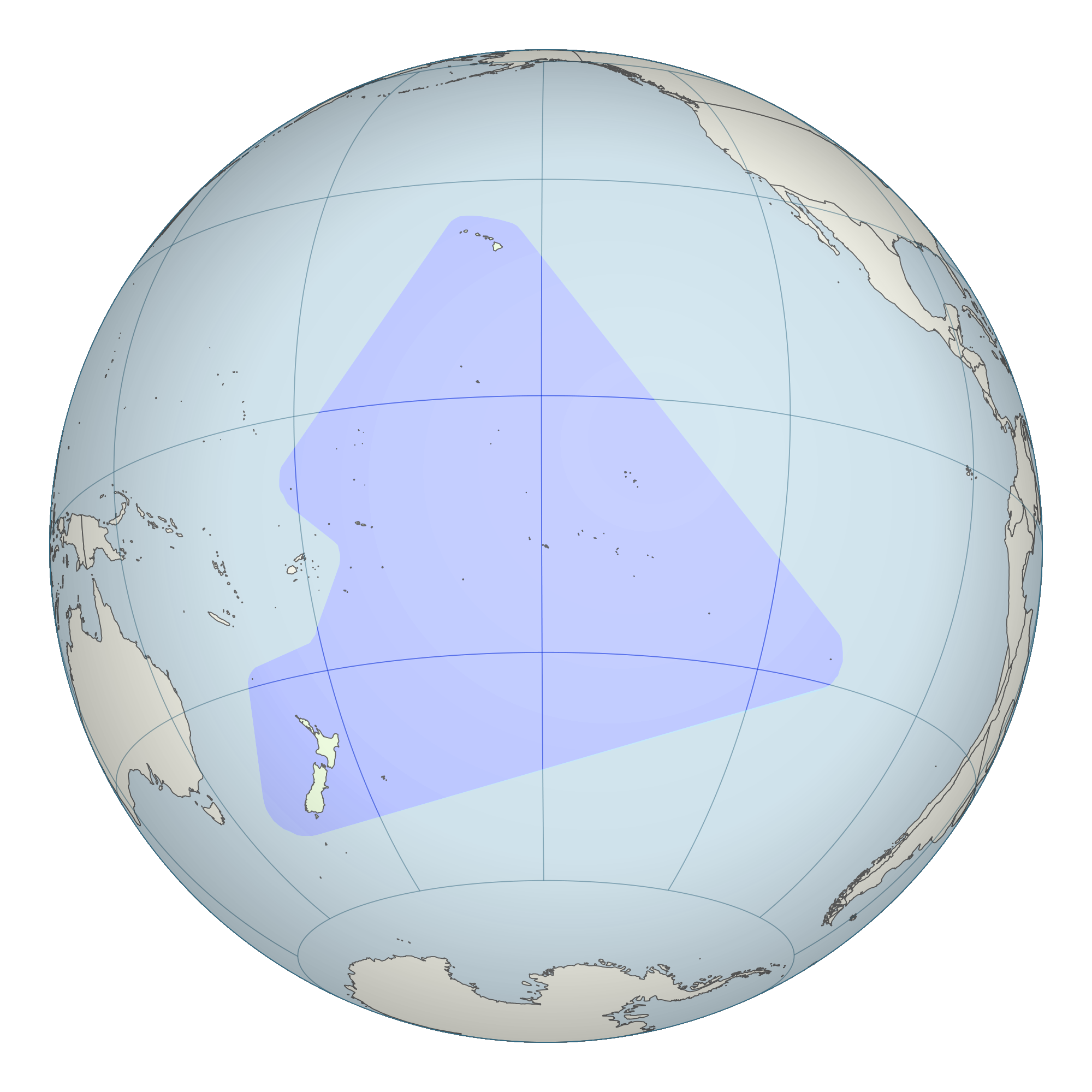
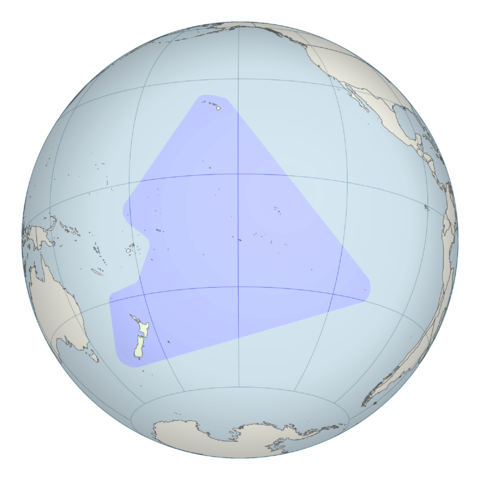
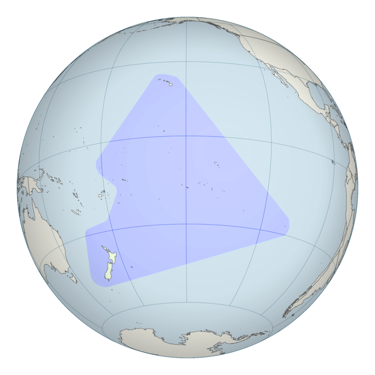
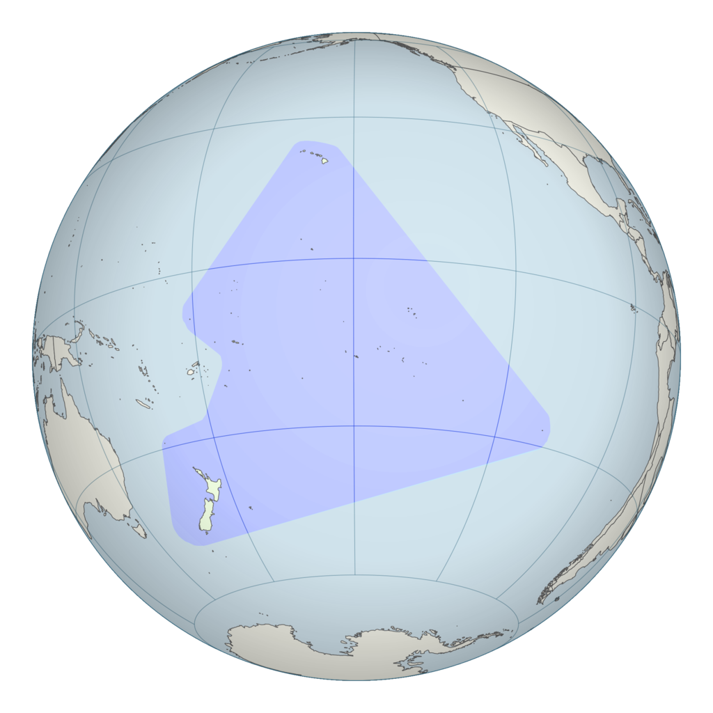
English: Polynesian triangle stretching from New Zealand in the south to Easter Island in the east and Hawaii in the north. This is a modification of File:French Polynesia (orthographic projection, yellowblue).svg. |
||
| दिनांक | ( | ||
| स्रोत | See File:French Polynesia (orthographic projection, yellowblue).svg; Map information based on Vaka Moana: Voyages of the Ancestors - the discovery and settlement of the Pacific, ed K.R. Howe, 2008, p57. | ||
| लेखक | User:Kahuroa | ||
| अनुमति (इस चित्र का पुनः उपयोग करना) |
|
.svg)
| Annotations | This image is annotated: View the annotations at Commons |
चित्र का इतिहास
फ़ाइलका पुराना अवतरण देखने के लिये दिनांक/समय पर क्लिक करें।
| दिनांक/समय | थंबनेल | आकार | सदस्य | प्रतिक्रिया | |
|---|---|---|---|---|---|
| वर्तमान | 20:43, 26 अक्टूबर 2010 | | 2,000 × 2,000 (605 KB) | Kahuroa | include Norfolk Island |
| 05:15, 26 अक्टूबर 2010 |  | 2,000 × 2,000 (615 KB) | Kahuroa | more colour for background | |
| 04:15, 26 अक्टूबर 2010 |  | 2,000 × 2,000 (573 KB) | Kahuroa | new version - corrects gross geographic errors of previous one. | |
| 08:43, 23 अगस्त 2007 |  | 386 × 298 (4 KB) | Quizimodo~commonswiki | updated; removing NZ (c.f. Australasia) | |
| 13:32, 3 अप्रैल 2007 |  | 386 × 298 (36 KB) | TadejM | {{Information |Description=This is a simple modification of en:Image:BlankMap-World.png. |Source=Originally from [http://en.wikipedia.org en.wikipedia]; description page is/was [http://en.wikipedia.org/w/index.php?title=Image%3APolynesia.png here]. | |
चित्र का उपयोग
निम्नलिखित पन्ने इस चित्र से जुडते हैं :
चित्र का वैश्विक उपयोग
इस चित्र का उपयोग इन दूसरे विकियों में किया जाता है:
- ar.wikipedia.org पर उपयोग
- bpy.wikipedia.org पर उपयोग
- মার্শাল দ্বীপমালার চিনত্হান
- ওশেনিয়ার চিনত্হান
- নাউরুর চিনত্হান
- নিউজিল্যান্ডর চিনত্হান
- পালাউর চিনত্হান
- পাপুয়া নিউগিনির চিনত্হান
- সামোয়ার চিনত্হান
- সলোমন দ্বীপমালার চিনত্হান
- টঙ্গার চিনত্হান
- টুভালুর চিনত্হান
- ভানুয়াতুর চিনত্হান
- ফিজির চিনত্হান
- কিরিবাতির চিনত্হান
- অস্ট্রেলিয়ার চিনত্হান
- মাইক্রোনেশিয়া তিলপারাষ্ট্রর চিনত্হান
- মডেল:ওশেনিয়ার বারে
- অস্ট্রেলিয়ার ফিরালহান
- ফিজির ফিরালহান
- কিরিবাতির ফিরালহান
- মার্শাল দ্বীপমালার ফিরালহান
- মাইক্রোনেশিয়া তিলপারাষ্ট্রর ফিরালহান
- নাউরুর ফিরালহান
- নিউজিল্যান্ডর ফিরালহান
- পালাউর ফিরালহান
- পাপুয়া নিউগিনির ফিরালহান
- সামোয়ার ফিরালহান
- সলোমন দ্বীপমালার ফিরালহান
- টঙ্গার ফিরালহান
- টুভালুর ফিরালহান
- ভানুয়াতুর ফিরালহান
- অস্ট্রেলিয়া
- ফিজি
- কিরিবাতি
- মার্শাল দ্বীপমালা
- মাইক্রোনেশিয়া তিলপারাষ্ট্র
- নাউরু
- নিউজিল্যান্ড
- পালাউ
- পাপুয়া নিউগিনি
- সামোয়া
- সলোমন দ্বীপমালা
- টঙ্গা
- টুভালু
इस चित्र के वैश्विक उपयोग की अधिक जानकारी देखें।