चित्र:PrintingError.jpg
इस पूर्वावलोकन का आकार: 799 × 600 पिक्सेल। दूसरे रेसोल्यूशन्स: 320 × 240 पिक्सेल | 640 × 480 पिक्सेल | 1,024 × 768 पिक्सेल | 1,280 × 961 पिक्सेल | 2,560 × 1,921 पिक्सेल | 3,294 × 2,472 पिक्सेल।
मूल चित्र ((3,294 × 2,472 पिक्सेल, फ़ाइल का आकार: 2.28 MB, MIME प्रकार: image/jpeg))
|
|
यह फ़ाइल विकिमेडिया कॉमन्स से है। वहाँ पर इसका विवरण पृष्ठ निम्नोक्त है। कॉमन्स मुक्त लाइसेंसों के अंतर्गत उपलब्ध मीडिया फ़ाइलों का संग्रह है। आप भी इसमें मदद कर सकते हैं। |
| विवरण |
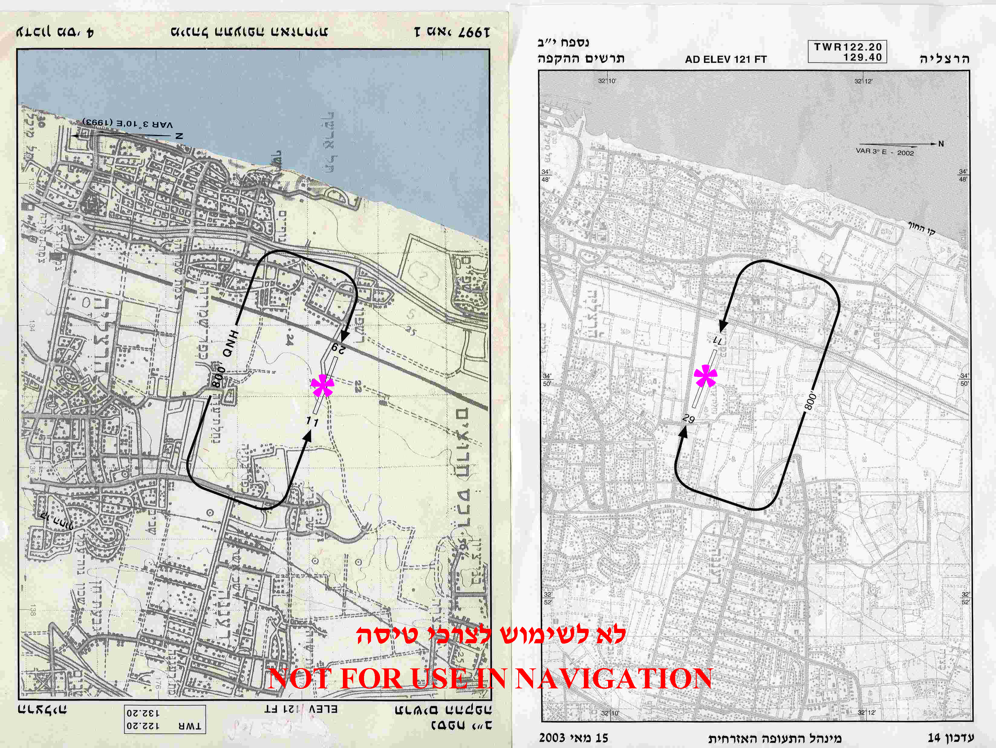
English: Herzliya Airport (Israel) Runway location and Traffic Pattern chart (left) was erroneously printed as a result of "black layer" 180° misplacement. The corrected chart is on the right. |
||
| दिनांक | |||
| स्रोत | Aeronautical Information Publication - Domestic (AIP) of the Israel Civil Aviation Administration – presently Civil Aviation Authority (CAA) | ||
| लेखक | Etan Tal | ||
| अनुमति (इस चित्र का पुनः उपयोग करना) |
|
Image to be used for illustration of aviation articles. Not for actual navigation. Original image is public domain (State Regulations) - uploader added the disclaimers prohibiting navigation use in compliance with normal aviation practice. Modified image released to the public domain as well.
चित्र का इतिहास
फ़ाइलका पुराना अवतरण देखने के लिये दिनांक/समय पर क्लिक करें।
| दिनांक/समय | थंबनेल | आकार | सदस्य | प्रतिक्रिया | |
|---|---|---|---|---|---|
| वर्तमान | 22:51, 5 अक्टूबर 2009 | | 3,294 × 2,472 (2.28 MB) | Etan J. Tal | {{Information |Description={{en|1=Herzliya Airport (Israel) Traffic Pattern chart (left) was erroneously misprinted in the wrong direction. The later corrected chart is on the right.}} |Source=Aeronautical Information Publication - Domestic (AIP) |
चित्र का उपयोग
निम्नलिखित पन्ने इस चित्र से जुडते हैं :
चित्र का वैश्विक उपयोग
इस चित्र का उपयोग इन दूसरे विकियों में किया जाता है:
- ar.wikipedia.org पर उपयोग
- en.wikipedia.org पर उपयोग
- es.wikipedia.org पर उपयोग
- he.wikipedia.org पर उपयोग