चित्र:Punjab districts blank.png
इससे बड़ा रेसोल्यूशन उपलब्ध नहीं हैं।
Punjab_districts_blank.png ((556 × 599 पिक्सेल, फ़ाइल का आकार: 106 KB, MIME प्रकार: image/png))
|
|
यह फ़ाइल विकिमेडिया कॉमन्स से है। वहाँ पर इसका विवरण पृष्ठ निम्नोक्त है। कॉमन्स मुक्त लाइसेंसों के अंतर्गत उपलब्ध मीडिया फ़ाइलों का संग्रह है। आप भी इसमें मदद कर सकते हैं। |

|
This locator map image could be re-created using vector graphics as an SVG file. This has several advantages; see Commons:Media for cleanup for more information. If an SVG form of this image is available, please upload it and afterwards replace this template with
{{vector version available|new image name}}.
It is recommended to name the SVG file “Punjab districts blank.svg”—then the template Vector version available (or Vva) does not need the new image name parameter. |
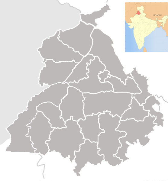
| विवरण | Blank map of districts of Punjab, India. |
| दिनांक | (UTC) |
| स्रोत | |
| लेखक |
|
| This is a retouched picture, which means that it has been digitally altered from its original version. The original can be viewed here: Punjab locator map.svg:
|
मैं, इस कार्य का/की कॉपीराइट धारक, इसे निम्न लाइसेंस के अंतर्गत प्रकाशित करता/करती हूँ:
इस फ़ाइल को क्रिएटिव कॉमन्स श्रेय-समानसांझा 3.0 अनरिपोर्टेड लाइसेंस के अंतर्गत लाइसेंस किया गया है।
- आप खुलकर:
- बाँट सकते हैं – रचना की प्रतिलिपि बना सकते हैं, बाँँट सकते हैं और संचारित कर सकते हैं
- रीमिक्स कर सकते हैं – कार्य को अनुकूलित कर सकते हैं
- निम्नलिखित शर्तों के अंतर्गत:
- श्रेय – यह अनिवार्य है कि आप यथोचित श्रेय प्रदान करें, लाइसेंस की कड़ी प्रदान करें, और अगर कोई बदलाव हुए हों तो उन्हें इंगित करें। आप ऐसा किसी भी उचित तरीके से कर सकते हैं, लेकिन किसी भी तरह उससे यह नहीं संकेत नहीं किया जाना चाहिए कि लाइसेंसधारी द्वारा आपको अथवा आपके इस प्रयोग का समर्थन किया जा रहा हो।
- समानसांझा – अगर आप इस रचना में कोई बदलाव करते हैं या इसपर आधारित कुछ रचित करते हैं तो आप अपने योगदान को सिर्फ इसी या इसके सामान किसी लाइसेंस के अंतर्गत बाँट सकते हैं।
मूल अपलोड लॉग
This image is a derivative work of the following images:
- File:Punjab_locator_map.svg licensed with Cc-by-sa-3.0
- 2007-04-25T18:25:41Z PlaneMad 2393x1956 (192941 Bytes) {{WikiProject_India_Maps |Title=Punjab locator map |Description=Locator map of the state of [[w:Punjab]], [[w:India|India]] with district boundaries, major highways, railways and water bodies. |Source=[www.punjabtourism.org/t
Uploaded with derivativeFX
चित्र का इतिहास
फ़ाइलका पुराना अवतरण देखने के लिये दिनांक/समय पर क्लिक करें।
| दिनांक/समय | थंबनेल | आकार | सदस्य | प्रतिक्रिया | |
|---|---|---|---|---|---|
| वर्तमान | 20:39, 11 जून 2013 | | 556 × 599 (106 KB) | Jujhar.pannu | Modified district borders adding Pathankot and slight touchups |
| 03:12, 24 सितंबर 2009 |  | 955 × 1,029 (155 KB) | Abhijitsathe | {{Information |Description=Blank map of districts of Punjab, India. |Source=*File:Punjab_locator_map.svg |Date=2009-09-24 03:11 (UTC) |Author=*File:Punjab_locator_map.svg: '''PlaneMad''' *derivative work: ~~~ |Permission=see |
चित्र का उपयोग
इस चित्र से कोई पन्ने नहीं जुड़ते
चित्र का वैश्विक उपयोग
इस चित्र का उपयोग इन दूसरे विकियों में किया जाता है:
- bn.wikipedia.org पर उपयोग
- জিরা, পাঞ্জাব
- জিরাকপুর
- চোহাল
- আবোহার
- দারোহা
- দাসুয়া
- দৌলতপুর (পাঞ্জাব)
- ডেরা বাবা নানক
- ডেরা বাস্সি
- ধানাউলা
- ধরমকোট
- ধারিওয়াল
- ধিলওয়ান
- ধুরি
- দিনা নগর
- দিরবা
- ফরিদকোট
- ফতেহগড় চুরিয়ান
- ফাজিলকা
- ফিরোজপুর
- ফিরোজপুর ক্যন্টনমেন্ট
- গার্দিওয়ালা
- গড়শানকের
- ঘাগ্গা
- গানৌর
- গিদ্দেরবাহা
- গোনিয়ানা
- আমলোহ
- গোরায়া
- গুরুদাসপুর
- গুরু হর শাহি
- হানদিয়া
- হরিয়ানা (পাঞ্জাব)
- হোশিয়ারপুর
- হুসেইনপুর
- আনন্দপুর সাহিব
- জাগরাওন
- জয়তু
- জালালাবাদ, ফাজিলকা
- জলন্ধর
- জলন্ধর ক্যন্টনমেন্ট
- জান্দিয়ালা গুরু
- জান্দিয়ালা (জলন্ধর)
- জুগিয়াল
- কালানৌর
- কাপুরথালা, পাঞ্জাব
- কারোরান
- কার্টাপুর
- আদমপুর (পাঞ্জাব)
- খামানোন
इस चित्र के वैश्विक उपयोग की अधिक जानकारी देखें।