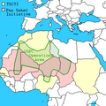
चित्र:Southern Sudan Civil War.svg

पूर्वावलोकन PNG का आकार SVG फ़ाइल: 800 × 581 पिक्सेल दूसरे रेसोल्यूशन्स: 320 × 232 पिक्सेल | 640 × 465 पिक्सेल | 1,024 × 743 पिक्सेल | 1,280 × 929 पिक्सेल | 2,560 × 1,858 पिक्सेल | 1,561 × 1,133 पिक्सेल।
मूल चित्र (SVG फ़ाइल, साधारणतः 1,561 × 1,133 पिक्सेल, फ़ाइल का आकार: 1.71 MB)
चित्र का इतिहास
फ़ाइलका पुराना अवतरण देखने के लिये दिनांक/समय पर क्लिक करें।
| दिनांक/समय | थंबनेल | आकार | सदस्य | प्रतिक्रिया | |
|---|---|---|---|---|---|
| वर्तमान | 19:20, 14 दिसम्बर 2021 |  | 1,561 × 1,133 (1.71 MB) | Borysk5 | Added new map based on 2021 IPIS interactive roadblock map: https://ipisresearch.be/publication/checkpoint-economy-the-political-economy-of-checkpoints-in-south-sudan-ten-years-after-independence/ (selected SPLA-IO and SPLA checkpoints) |
| 17:19, 22 मार्च 2020 |  | 1,561 × 1,133 (292 KB) | Borysk5 | Update based on template | |
| 21:27, 1 अप्रैल 2016 |  | 1,561 × 1,133 (255 KB) | Ermanarich | Derived from the Template. Opposition forces arrived in Juba as part of implementation of the Agreement on the Resolution of the Conflict. Wau, Malakal, Nasir, Mir Mir and Rupkuai contested, some v... | |
| 05:50, 21 फ़रवरी 2016 |  | 1,561 × 1,133 (231 KB) | Oganesson007 | User created page with UploadWizard |
चित्र का उपयोग
निम्नलिखित पन्ने इस चित्र से जुडते हैं :
चित्र का वैश्विक उपयोग
इस चित्र का उपयोग इन दूसरे विकियों में किया जाता है:
- ar.wikipedia.org पर उपयोग
- az.wikipedia.org पर उपयोग
- bn.wikipedia.org पर उपयोग
- ca.wikipedia.org पर उपयोग
- cs.wikipedia.org पर उपयोग
- de.wikipedia.org पर उपयोग
- de.wikivoyage.org पर उपयोग
- en.wikipedia.org पर उपयोग
- eo.wikipedia.org पर उपयोग
- es.wikipedia.org पर उपयोग
- fr.wikipedia.org पर उपयोग
- he.wikipedia.org पर उपयोग
- id.wikipedia.org पर उपयोग
- it.wikipedia.org पर उपयोग
- ja.wikipedia.org पर उपयोग
- ko.wikipedia.org पर उपयोग
- lv.wikipedia.org पर उपयोग
- pt.wikipedia.org पर उपयोग
- ru.wikipedia.org पर उपयोग
- sr.wikipedia.org पर उपयोग
- te.wikipedia.org पर उपयोग
- th.wikipedia.org पर उपयोग
- tr.wikipedia.org पर उपयोग
- tum.wikipedia.org पर उपयोग
- www.wikidata.org पर उपयोग
- zh.wikipedia.org पर उपयोग


