चित्र:Tierra del Fuego location map.svg

मूल चित्र (SVG फ़ाइल, साधारणतः 1,535 × 1,550 पिक्सेल, फ़ाइल का आकार: 824 KB)
|
|
यह फ़ाइल विकिमेडिया कॉमन्स से है। वहाँ पर इसका विवरण पृष्ठ निम्नोक्त है। कॉमन्स मुक्त लाइसेंसों के अंतर्गत उपलब्ध मीडिया फ़ाइलों का संग्रह है। आप भी इसमें मदद कर सकते हैं। |
सारांश
| विवरण |
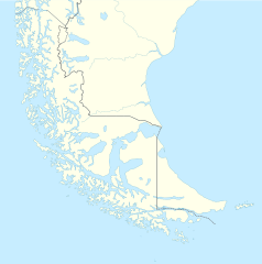
Deutsch: Positionskarte von Feuerland und Umgebung
Quadratische Plattkarte, N-S-Streckung 160 %. Geographische Begrenzung der Karte:
English: Location map of Tierra del Fuego and surroundings
Equirectangular projection, N/S stretching 160 %. Geographic limits of the map:
Español: Ubicación de Tierra del Fuego y alrededores
Proyección equirectangular, N/S 160% de estiramiento. Límites geográficos del mapa:
|
|
| दिनांक | ||
| स्रोत |
अपना कार्य, using
|
|
| लेखक | NordNordWest | |
| अनुमति (इस चित्र का पुनः उपयोग करना) |
इस फ़ाइल को क्रिएटिव कॉमन्स श्रेय-समानसांझा 3.0 जर्मनी लाइसेंस के अंतर्गत लाइसेंस किया गया है।
 इस फ़ाइल को क्रिएटिव कॉमन्स श्रेय-समानसांझा 3.0 जर्मनी लाइसेंस के अंतर्गत लाइसेंस किया गया है।
|
|
| दूसरे संस्करण |
Derivative works of this file: |

.svg)

|
This map has been made or improved in the German Kartenwerkstatt (Map Lab). You can propose maps to improve as well.
|
चित्र का इतिहास
फ़ाइलका पुराना अवतरण देखने के लिये दिनांक/समय पर क्लिक करें।
| दिनांक/समय | थंबनेल | आकार | सदस्य | प्रतिक्रिया | |
|---|---|---|---|---|---|
| वर्तमान | 16:20, 5 मार्च 2024 | | 1,535 × 1,550 (824 KB) | Janitoalevic | More specific Beagle Channel |
| 01:23, 29 दिसम्बर 2022 |  | 1,535 × 1,550 (588 KB) | Janitoalevic | Improved borders | |
| 19:41, 3 मई 2020 |  | 1,535 × 1,550 (566 KB) | Janitoalevic | Improved Isla de los Estados | |
| 18:47, 3 मई 2020 |  | 1,535 × 1,550 (558 KB) | Janitoalevic | Improved | |
| 23:23, 29 अगस्त 2017 |  | 1,535 × 1,550 (441 KB) | Janitoalevic | Fixed size | |
| 11:23, 29 अगस्त 2017 |  | 1,535 × 1,550 (510 KB) | NordNordWest | Reverted to version as of 20:59, 15 March 2016 (UTC); change of size is catastrophic to some templates | |
| 22:18, 28 अगस्त 2017 |  | 1,638 × 1,653 (442 KB) | Janitoalevic | More precise borders and lakes | |
| 20:59, 15 मार्च 2016 |  | 1,535 × 1,550 (510 KB) | Janitoalevic | Fixed limits following Google Earth/maps limits | |
| 22:12, 2 मार्च 2016 |  | 1,535 × 1,550 (510 KB) | Janitoalevic | Updated | |
| 20:34, 11 सितंबर 2015 |  | 1,535 × 1,550 (508 KB) | Janitoalevic | Added Southern Patagonian Ice Field (Campo de hielo Patagónico Sur) undefined limits part, since 1998 For more information read: https://en.wikipedia.org/wiki/Southern_Patagonian_Ice_Field#Borderline Now with full resolution. |
चित्र का उपयोग
निम्नलिखित पन्ने इस चित्र से जुडते हैं :
चित्र का वैश्विक उपयोग
इस चित्र का उपयोग इन दूसरे विकियों में किया जाता है:
- als.wikipedia.org पर उपयोग
- ar.wikipedia.org पर उपयोग
- az.wikipedia.org पर उपयोग
- ba.wikipedia.org पर उपयोग
- bn.wikipedia.org पर उपयोग
- ceb.wikipedia.org पर उपयोग
- cs.wikipedia.org पर उपयोग
- da.wikipedia.org पर उपयोग
- de.wikipedia.org पर उपयोग
- el.wikipedia.org पर उपयोग
- en.wikipedia.org पर उपयोग
- Tierra del Fuego
- Ushuaia – Malvinas Argentinas International Airport
- Isla Grande de Tierra del Fuego
- Puerto Williams
- Río Grande, Tierra del Fuego
- Diego Ramírez Islands
- Riesco Island
- Hoste Island
- Viedma (volcano)
- Cerro Torre
- Fitz Roy
- Viedma Lake
- Gallegos River
- Mount Darwin (Andes)
- Puerto Toro
- Dawson Island
- Ildefonso Islands
- Hermite Islands
- Southern Patagonian Ice Field
- Navarino Island
- Cordillera Darwin
- Cordillera Sarmiento
- Londonderry Island
- Hornos Island
- Grey Lake
- Desolación Island
- Clarence Island, Chile
- Gordon Island
- Juan Guillermos Island
इस चित्र के वैश्विक उपयोग की अधिक जानकारी देखें।