चित्र:White Sea Canal map.png

इस पूर्वावलोकन का आकार: 699 × 600 पिक्सेल। दूसरे रेसोल्यूशन्स: 280 × 240 पिक्सेल | 560 × 480 पिक्सेल | 1,000 × 858 पिक्सेल।
मूल चित्र ((1,000 × 858 पिक्सेल, फ़ाइल का आकार: 351 KB, MIME प्रकार: image/png))
|
|
यह फ़ाइल विकिमेडिया कॉमन्स से है। वहाँ पर इसका विवरण पृष्ठ निम्नोक्त है। कॉमन्स मुक्त लाइसेंसों के अंतर्गत उपलब्ध मीडिया फ़ाइलों का संग्रह है। आप भी इसमें मदद कर सकते हैं। |

|
This locator map image could be re-created using vector graphics as an SVG file. This has several advantages; see Commons:Media for cleanup for more information. If an SVG form of this image is available, please upload it and afterwards replace this template with
{{vector version available|new image name}}.
It is recommended to name the SVG file “White Sea Canal map.svg”—then the template Vector version available (or Vva) does not need the new image name parameter. |
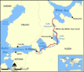
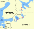
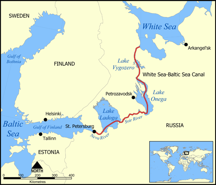
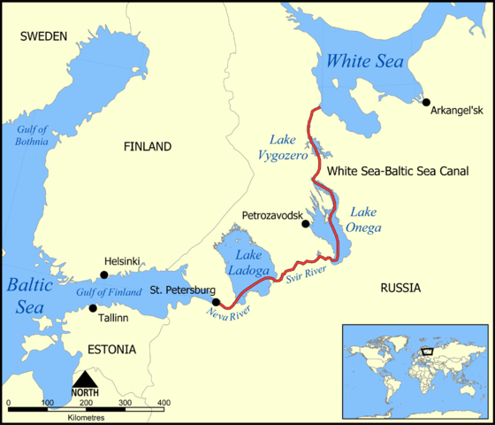
This map shows the route of the White Sea-Baltic Sea Canal ("Belomorkanal") between the White Sea and Baltic Sea. It shows the lakes Vygozero, Onega, and Ladoga, and the Svir' and Neva rivers too.
Created by NormanEinstein, December 6, 2005.
मैं, इस कार्य का/की कॉपीराइट धारक, इसे निम्न लाइसेंस के अंतर्गत प्रकाशित करता/करती हूँ:

|
इस दस्तावेज़ को Free Software Foundation द्वारा प्रकाशित GNU मुक्त प्रलेख लाइसेंस के संस्करण 1.2 या नए (बिना किसी अपरिवर्तनीय अनुभागों और अगले या पिछले आवरण के टेक्स्ट के) के अंतर्गत प्रतिलिपि बनाने, बाँटने और/या बदलने की अनुमति प्रदान की जाती है। इस लाइसेंस की एक प्रतिलिपि GNU मुक्त प्रलेख लाइसेंस नामक अनुभाग में शामिल है। |
| इस फ़ाइल को क्रिएटिव कॉमन्स श्रेय-समानसांझा 3.0 अनरिपोर्टेड लाइसेंस के अंतर्गत लाइसेंस किया गया है। | ||
| ||
| This licensing tag was added to this file as part of the GFDL licensing update. |
Derivative works
[]
-
 Deutsch
 -
 English
 -
 français
 -
 hrvatski
 -
 עברית
עברית


चित्र का इतिहास
फ़ाइलका पुराना अवतरण देखने के लिये दिनांक/समय पर क्लिक करें।
| दिनांक/समय | थंबनेल | आकार | सदस्य | प्रतिक्रिया | |
|---|---|---|---|---|---|
| वर्तमान | 17:59, 6 दिसम्बर 2005 | | 1,000 × 858 (351 KB) | NormanEinstein | This map shows the route of the White Sea-Baltic Sea Canal between the White Sea and Baltic Sea. (Heh heh.) It shows the lakes Vygozero, Onega, and Ladoga, and the Sivr and Neva rivers too. Created by NormanEinstein, December 6, 2005. {{GFDL-self}} [[C |
चित्र का उपयोग
निम्नलिखित पन्ने इस चित्र से जुडते हैं :
चित्र का वैश्विक उपयोग
इस चित्र का उपयोग इन दूसरे विकियों में किया जाता है:
- af.wikipedia.org पर उपयोग
- ar.wikipedia.org पर उपयोग
- arz.wikipedia.org पर उपयोग
- ast.wikipedia.org पर उपयोग
- bg.wikipedia.org पर उपयोग
- ca.wikipedia.org पर उपयोग
- cs.wikipedia.org पर उपयोग
- da.wikipedia.org पर उपयोग
- en.wikipedia.org पर उपयोग
- es.wikipedia.org पर उपयोग
- fa.wikipedia.org पर उपयोग
- fr.wikipedia.org पर उपयोग
- fy.wikipedia.org पर उपयोग
- id.wikipedia.org पर उपयोग
- incubator.wikimedia.org पर उपयोग
- is.wikipedia.org पर उपयोग
- it.wikipedia.org पर उपयोग
- ja.wikipedia.org पर उपयोग
- ko.wikipedia.org पर उपयोग
- lt.wikipedia.org पर उपयोग
- lv.wikipedia.org पर उपयोग
- mk.wikipedia.org पर उपयोग
- nl.wikipedia.org पर उपयोग
- no.wikipedia.org पर उपयोग
- pl.wikipedia.org पर उपयोग
- pt.wikipedia.org पर उपयोग
- qu.wikipedia.org पर उपयोग
- ro.wikipedia.org पर उपयोग
- ru.wikipedia.org पर उपयोग
- simple.wikipedia.org पर उपयोग
- sl.wikipedia.org पर उपयोग
इस चित्र के वैश्विक उपयोग की अधिक जानकारी देखें।