चित्र:Wimbledon map.jpg
इस पूर्वावलोकन का आकार: 514 × 599 पिक्सेल। दूसरे रेसोल्यूशन्स: 206 × 240 पिक्सेल | 412 × 480 पिक्सेल | 659 × 768 पिक्सेल | 879 × 1,024 पिक्सेल | 2,218 × 2,585 पिक्सेल।
मूल चित्र ((2,218 × 2,585 पिक्सेल, फ़ाइल का आकार: 4.6 MB, MIME प्रकार: image/jpeg))
|
|
यह फ़ाइल विकिमेडिया कॉमन्स से है। वहाँ पर इसका विवरण पृष्ठ निम्नोक्त है। कॉमन्स मुक्त लाइसेंसों के अंतर्गत उपलब्ध मीडिया फ़ाइलों का संग्रह है। आप भी इसमें मदद कर सकते हैं। |
सारांश
| विवरण |
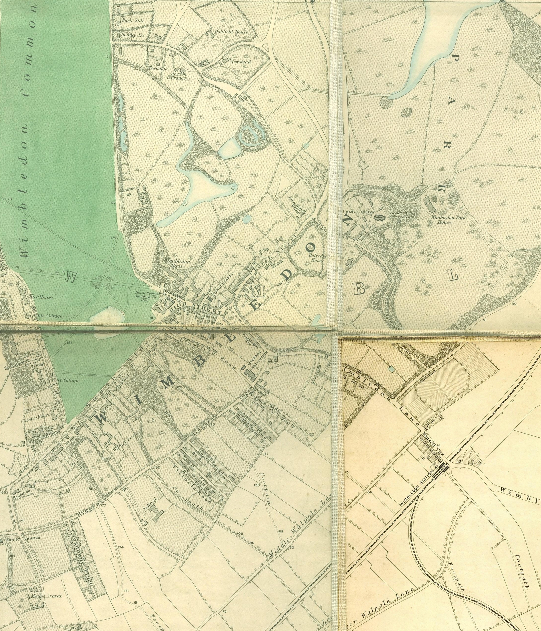
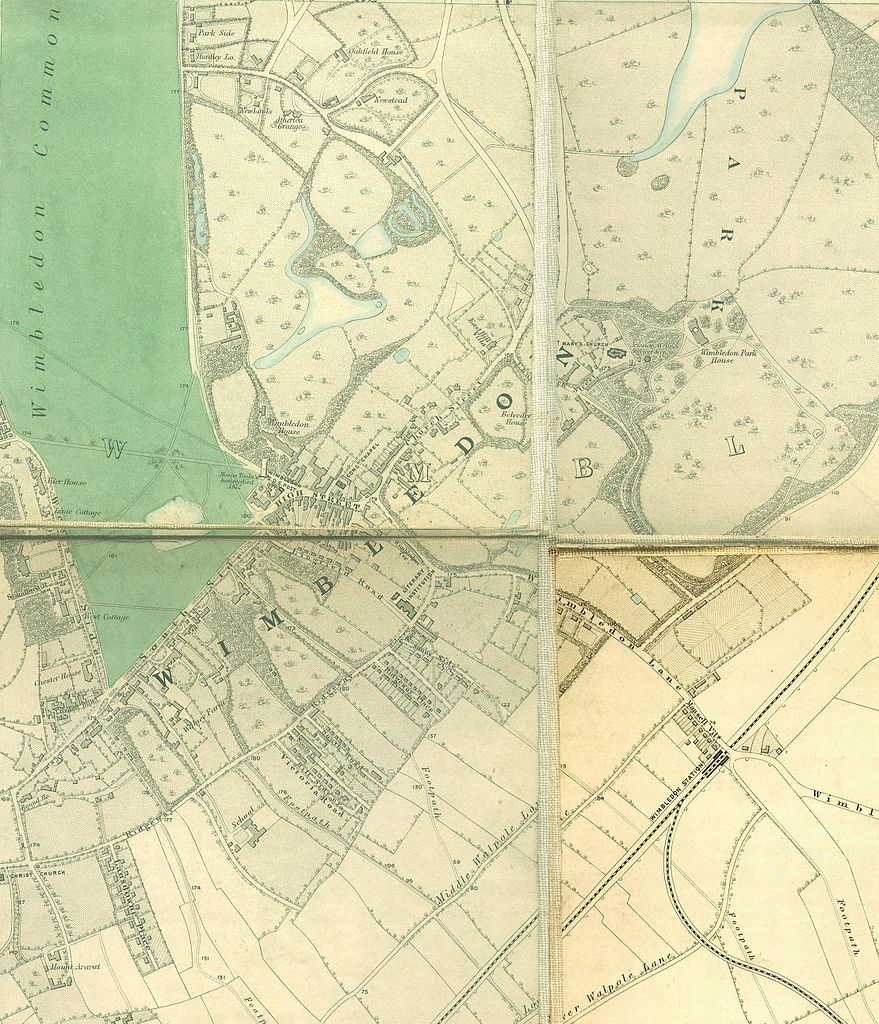
English: Wimbledon section of Edward Stanford's map of London, 1862 - 1871 |
|||||||||||||||||||
| दिनांक | १८६२ और १८७१ के बीच | |||||||||||||||||||
| स्रोत | http://www.mappalondon.com/london/south-west/maps.htm | |||||||||||||||||||
| लेखक |
|
|||||||||||||||||||
लाइसेंस
|
This work is in the public domain in its country of origin and other countries and areas where the copyright term is the author's life plus 100 years or fewer. | |
| इस फ़ाइल को कॉपीराइट कानूनों के अंतर्गत सभी संबंधित अधिकारों समेत ज्ञात सीमाओं से मुक्त पहचाना गया है। | |
चित्र का इतिहास
फ़ाइलका पुराना अवतरण देखने के लिये दिनांक/समय पर क्लिक करें।
| दिनांक/समय | थंबनेल | आकार | सदस्य | प्रतिक्रिया | |
|---|---|---|---|---|---|
| वर्तमान | 18:42, 14 जनवरी 2011 | | 2,218 × 2,585 (4.6 MB) | SilkTork | {{Information |Description={{en|1=Wimbledon section of Edward Stanford's map of London, 1862 - 1871 }} |Source=http://www.mappalondon.com/london/south-west/maps.htm |Author=Edward Stanford (died 1904) |Date=18 |
चित्र का उपयोग
निम्नलिखित पन्ने इस चित्र से जुडते हैं :
चित्र का वैश्विक उपयोग
इस चित्र का उपयोग इन दूसरे विकियों में किया जाता है:
- en.wikipedia.org पर उपयोग
- kn.wikipedia.org पर उपयोग