चित्र:World map of submarine cables.png
इस पूर्वावलोकन का आकार: 800 × 512 पिक्सेल। दूसरे रेसोल्यूशन्स: 320 × 205 पिक्सेल | 640 × 410 पिक्सेल | 1,024 × 656 पिक्सेल | 1,280 × 819 पिक्सेल | 1,601 × 1,025 पिक्सेल।
मूल चित्र ((1,601 × 1,025 पिक्सेल, फ़ाइल का आकार: 74 KB, MIME प्रकार: image/png))
|
|
यह फ़ाइल विकिमेडिया कॉमन्स से है। वहाँ पर इसका विवरण पृष्ठ निम्नोक्त है। कॉमन्स मुक्त लाइसेंसों के अंतर्गत उपलब्ध मीडिया फ़ाइलों का संग्रह है। आप भी इसमें मदद कर सकते हैं। |

|
This economic map image could be re-created using vector graphics as an SVG file. This has several advantages; see Commons:Media for cleanup for more information. If an SVG form of this image is available, please upload it and afterwards replace this template with
{{vector version available|new image name}}.
It is recommended to name the SVG file “World map of submarine cables.svg”—then the template Vector version available (or Vva) does not need the new image name parameter. |
| विवरण |
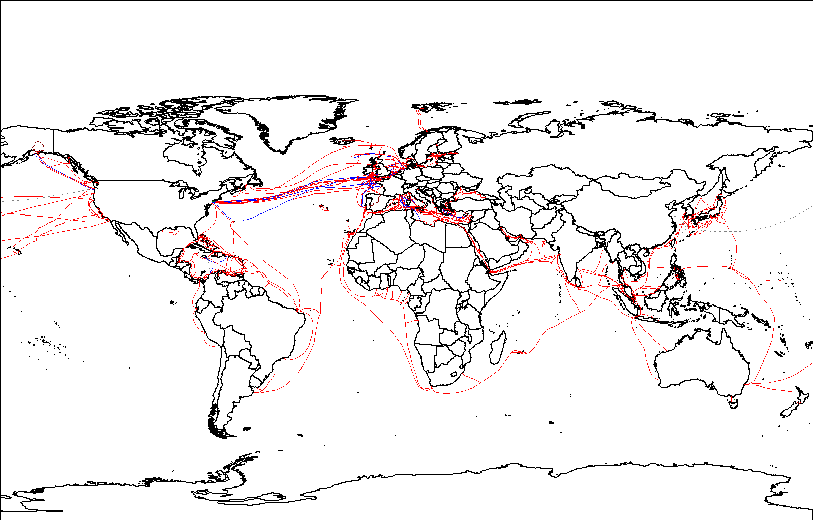
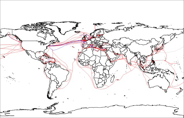
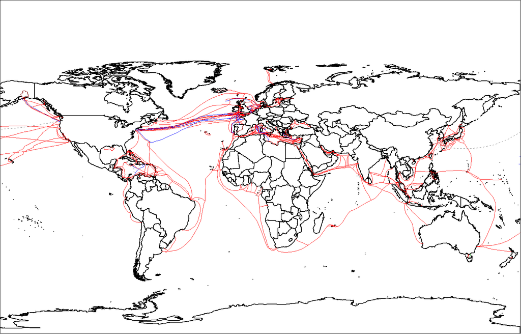
English: Map showing submarine telecommunication cables around the world in 2007. (See this map, for later cables). |
||
| दिनांक | |||
| स्रोत | Originally uploaded with the filename Submarine cables.png, overwriting the previous version. That version was restored so this is now being uploaded with a different filename. | ||
| लेखक | Rarelibra | ||
| अनुमति (इस चित्र का पुनः उपयोग करना) |
|
||
| दूसरे संस्करण |
|

चित्र का इतिहास
फ़ाइलका पुराना अवतरण देखने के लिये दिनांक/समय पर क्लिक करें।
| दिनांक/समय | थंबनेल | आकार | सदस्य | प्रतिक्रिया | |
|---|---|---|---|---|---|
| वर्तमान | 13:17, 21 दिसम्बर 2008 | | 1,601 × 1,025 (74 KB) | Waldyrious | {{Information |Description = Map showing submarine telecommunication cables around the world. |Source = Originally uploaded with the filename File:Submarine cables.png, overwriting the previous version. That version was restored so this is now being |
चित्र का उपयोग
निम्नलिखित पन्ने इस चित्र से जुडते हैं :
चित्र का वैश्विक उपयोग
इस चित्र का उपयोग इन दूसरे विकियों में किया जाता है:
- ar.wikipedia.org पर उपयोग
- ar.wikiversity.org पर उपयोग
- az.wikipedia.org पर उपयोग
- de.wikipedia.org पर उपयोग
- el.wikipedia.org पर उपयोग
- en.wikipedia.org पर उपयोग
- es.wikipedia.org पर उपयोग
- et.wikipedia.org पर उपयोग
- fr.wikipedia.org पर उपयोग
- gl.wikipedia.org पर उपयोग
- hy.wikipedia.org पर उपयोग
- ko.wikipedia.org पर उपयोग
- ru.wikipedia.org पर उपयोग
- sl.wikipedia.org पर उपयोग
- tw.wikipedia.org पर उपयोग
- vi.wikipedia.org पर उपयोग
- www.wikidata.org पर उपयोग
- zh.wikipedia.org पर उपयोग
- zu.wikipedia.org पर उपयोग