चित्र:Zonal band.svg

पूर्वावलोकन PNG का आकार SVG फ़ाइल: 596 × 599 पिक्सेल दूसरे रेसोल्यूशन्स: 239 × 240 पिक्सेल | 477 × 480 पिक्सेल | 764 × 768 पिक्सेल | 1,018 × 1,024 पिक्सेल | 2,037 × 2,048 पिक्सेल | 717 × 721 पिक्सेल।
मूल चित्र (SVG फ़ाइल, साधारणतः 717 × 721 पिक्सेल, फ़ाइल का आकार: 60 KB)
|
|
यह फ़ाइल विकिमेडिया कॉमन्स से है। वहाँ पर इसका विवरण पृष्ठ निम्नोक्त है। कॉमन्स मुक्त लाइसेंसों के अंतर्गत उपलब्ध मीडिया फ़ाइलों का संग्रह है। आप भी इसमें मदद कर सकते हैं। |
सारांश
| विवरण |
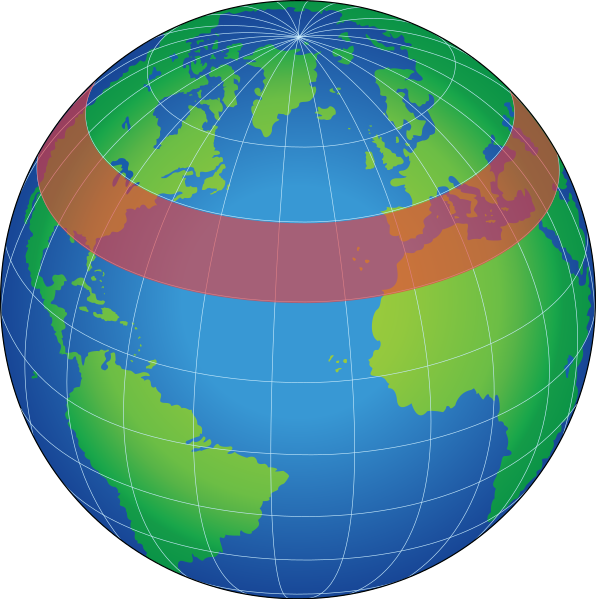
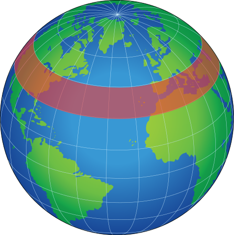
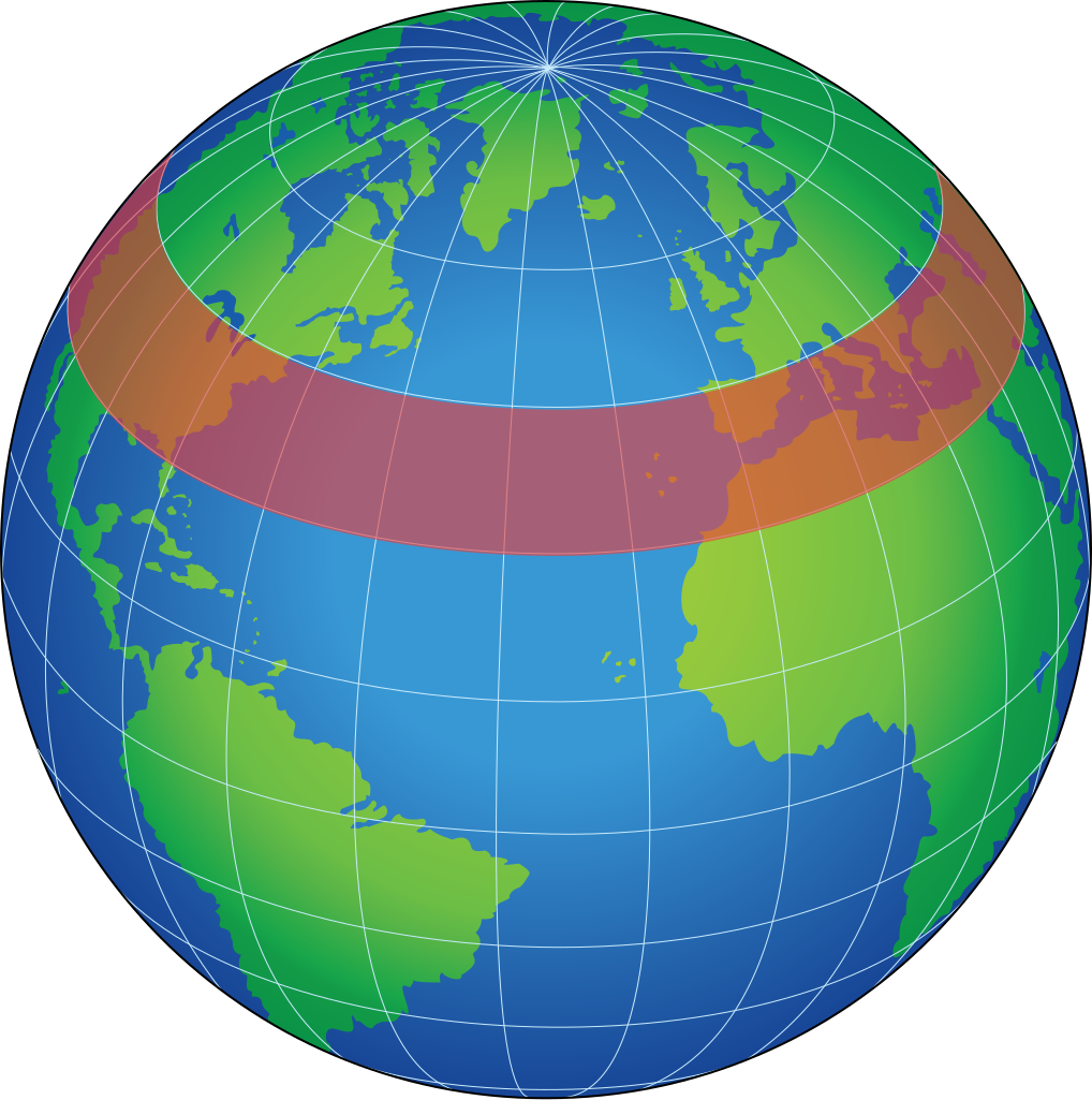
English: zonal band, a latitudinal circle (east-west direction) having any width in degrees latitude, used for the representation of data for an area of Earth's surface or atmosphere |
| दिनांक | (UTC) |
| स्रोत |
This file was derived from: |
| लेखक |
|


| This is a retouched picture, which means that it has been digitally altered from its original version. Modifications: Vectorized. The original can be viewed here: Globe Atlantic.svg:
|
लाइसेंस
यह चित्र अमेरिकी सेना या रक्षा विभाग के किसी कर्मचारी द्वारा उस व्यक्ति की आधिकारिक ज़िम्मेदारियों के एक भाग के रूप में लिया गया था। संयुक्त राज्य अमेरिका की संघीय सरकार का एक कार्य होने के नाते कार्य यह चित्र संयुक्त राज्य अमेरिका में सार्वजनिक डोमेन में है।
|
 |
मूल अपलोड लॉग
This image is a derivative work of the following images:
- File:Zonal_band.gif licensed with PD-USGov-NASA
- 2006-06-25T04:31:49Z Pflatau 485x485 (11219 Bytes) http://mynasadata.larc.nasa.gov/glossary.php?&word=ALL zonal band: a latitudinal circle (east-west direction) having any width in degrees latitude, used for the representation of data for an area of Earth's surface or atmos
- File:Globe_Atlantic.svg licensed with PD-USGov-Military
- 2008-10-18T20:04:36Z Clindberg 717x721 (60406 Bytes) {{Information |Description={{en|1=Globe graphic, centered on the northern Atlantic Ocean.}} |Source=Extracted from PDF version of the [http://www.disam.dsca.mil/pubs/archives.htm Vol 26-4 2004 DISAM Journal] (direct PDF URL [
Uploaded with derivativeFX
चित्र का इतिहास
फ़ाइलका पुराना अवतरण देखने के लिये दिनांक/समय पर क्लिक करें।
| दिनांक/समय | थंबनेल | आकार | सदस्य | प्रतिक्रिया | |
|---|---|---|---|---|---|
| वर्तमान | 00:08, 23 जनवरी 2012 | | 717 × 721 (60 KB) | Rehua | == {{int:filedesc}} == {{Information |Description={{en|1=zonal band, a latitudinal circle (east-west direction) having any width in degrees latitude, used for the representation of data for an area of Earth's surface or atmosphere}} |Source={{Derived from |
चित्र का उपयोग
निम्नलिखित पन्ने इस चित्र से जुडते हैं :
चित्र का वैश्विक उपयोग
इस चित्र का उपयोग इन दूसरे विकियों में किया जाता है:
- ca.wikipedia.org पर उपयोग
- de.wikipedia.org पर उपयोग
- en.wikipedia.org पर उपयोग
- hu.wikipedia.org पर उपयोग
- pl.wikipedia.org पर उपयोग
- www.wikidata.org पर उपयोग