चित्र:AA bedrock surface.4960.tif
पूर्वावलोकन JPG का आकार TIF फ़ाइल: 800 × 450 पिक्सेल दूसरे रेसोल्यूशन्स: 320 × 180 पिक्सेल | 640 × 360 पिक्सेल | 1,024 × 576 पिक्सेल | 1,280 × 720 पिक्सेल | 1,920 × 1,080 पिक्सेल।
मूल चित्र ((1,920 × 1,080 पिक्सेल, फ़ाइल का आकार: 2.4 MB, MIME प्रकार: image/tiff))
|
|
यह फ़ाइल विकिमेडिया कॉमन्स से है। वहाँ पर इसका विवरण पृष्ठ निम्नोक्त है। कॉमन्स मुक्त लाइसेंसों के अंतर्गत उपलब्ध मीडिया फ़ाइलों का संग्रह है। आप भी इसमें मदद कर सकते हैं। |
सारांश
| विवरण |
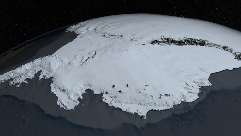
English: Since 2009, NASA's mission Operation IceBridge (OIB) has flown aircraft over the Antarctic Ice Sheet carrying laser and ice-penetrating radar instruments to collect data about the surface height, bedrock topography and ice thickness.
Source http://svs.gsfc.nasa.gov/cgi-bin/details.cgi?aid=4060 |
| दिनांक | |
| स्रोत | http://www.nasa.gov/topics/earth/features/antarctic-map.html |
| लेखक | NASA Goddard's Scientific Visualization Studio |
लाइसेंस
| This file is in the public domain in the United States because it was solely created by NASA. NASA copyright policy states that "NASA material is not protected by copyright unless noted". (See Template:PD-USGov, NASA copyright policy page or JPL Image Use Policy.) | ||
 |
Warnings:
|
चित्र का इतिहास
फ़ाइलका पुराना अवतरण देखने के लिये दिनांक/समय पर क्लिक करें।
| दिनांक/समय | थंबनेल | आकार | सदस्य | प्रतिक्रिया | |
|---|---|---|---|---|---|
| वर्तमान | 15:59, 1 अगस्त 2014 |  | 1,920 × 1,080 (2.4 MB) | Prokaryotes | User created page with UploadWizard |
चित्र का उपयोग
निम्नलिखित पन्ने इस चित्र से जुडते हैं :
चित्र का वैश्विक उपयोग
इस चित्र का उपयोग इन दूसरे विकियों में किया जाता है:
- be.wikipedia.org पर उपयोग
- en.wikipedia.org पर उपयोग
- es.wikipedia.org पर उपयोग
- fa.wikipedia.org पर उपयोग
- mk.wikipedia.org पर उपयोग
- oc.wikipedia.org पर उपयोग